Day 64 (Wednesday): September 11, 2019
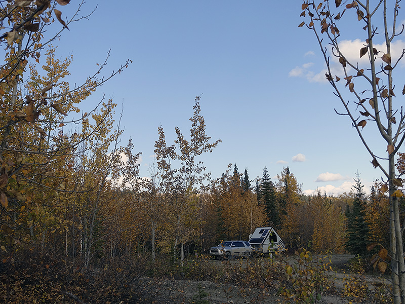
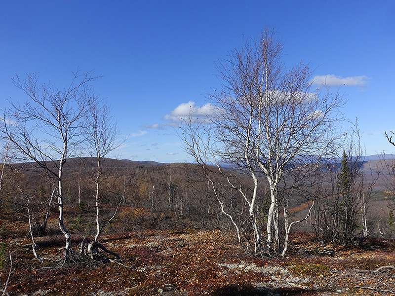
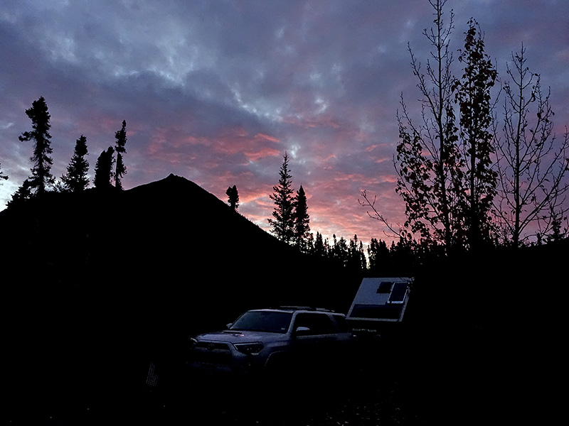
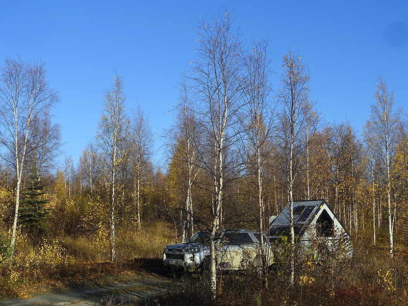
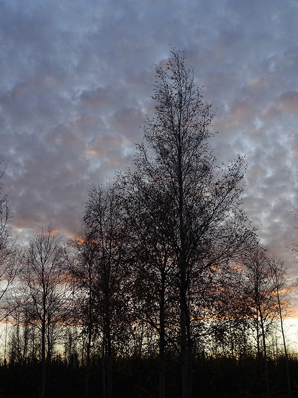
Woke up at 6 AM, and few times during the night, checked for the Northern Lights, but we did not see it. Got up at 6:30 AM, 38 oF washed me in fresh, cold river water, then after a good coffee, tea and breakfast, packed and left our camp. Drove on Elliott Hwy then on the Dalton Hwy to the Yukon River, got gas at Yukon River Camp, then drove to Milepost 60.5, to the 5 Mile BML Camp, where we set up our free, peaceful camp. Collected and chopped firewood, collected fresh clean water, made a long-lasting campfire. After dinner, looked around the camp area, took few photographs. We had a great almost full moon moonrise at 9:50 PM. We saw the Northern Lights as a green band not too much above the horizon at midnight. 28 oF… was cold a bit.
Day 65 (Thursday): September 12, 2019
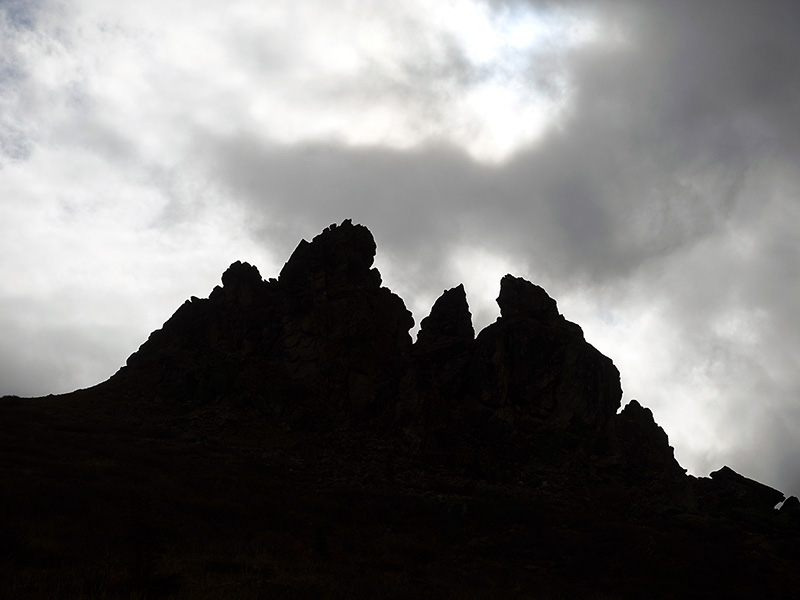
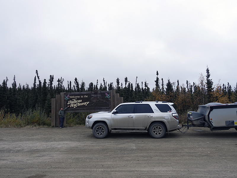
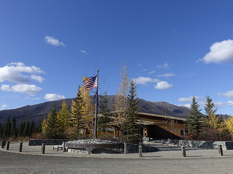
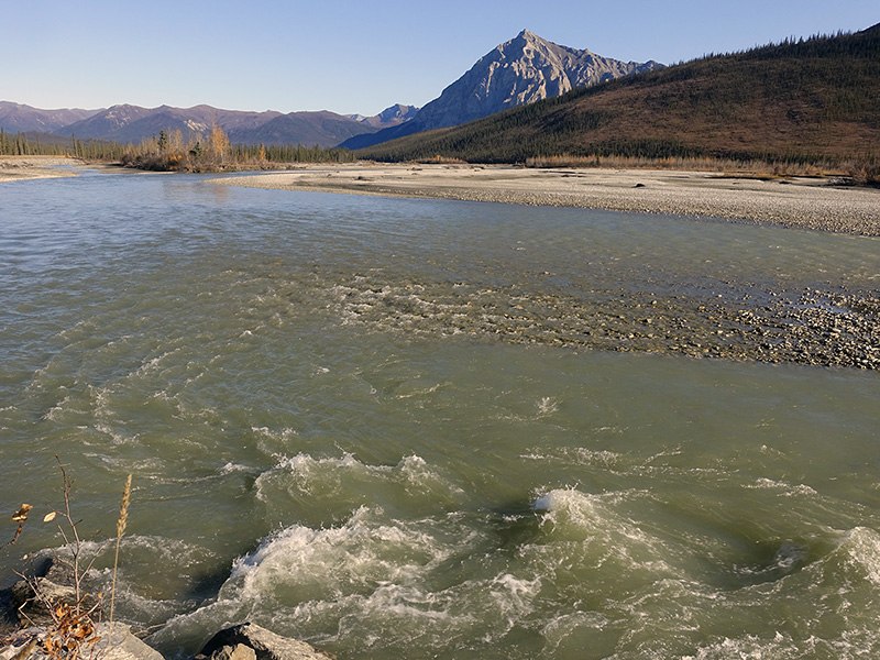
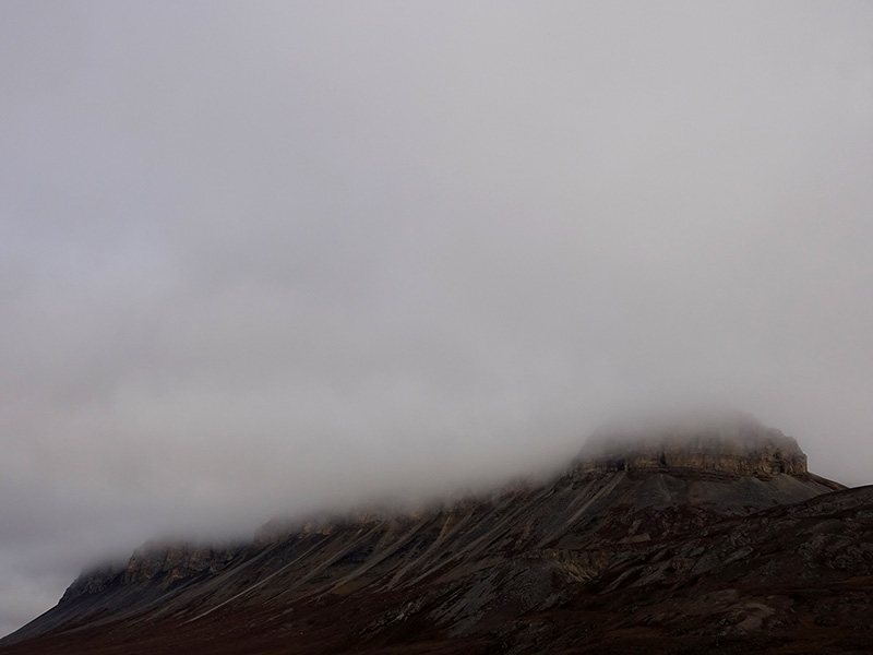
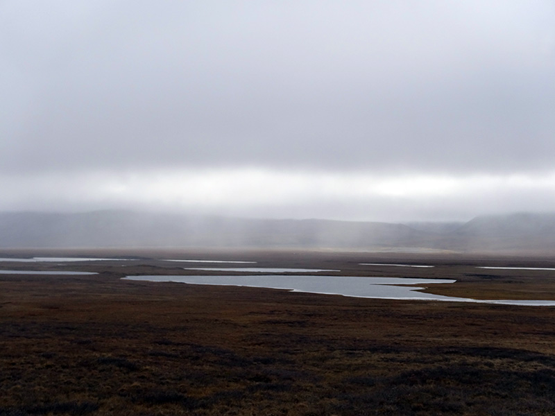
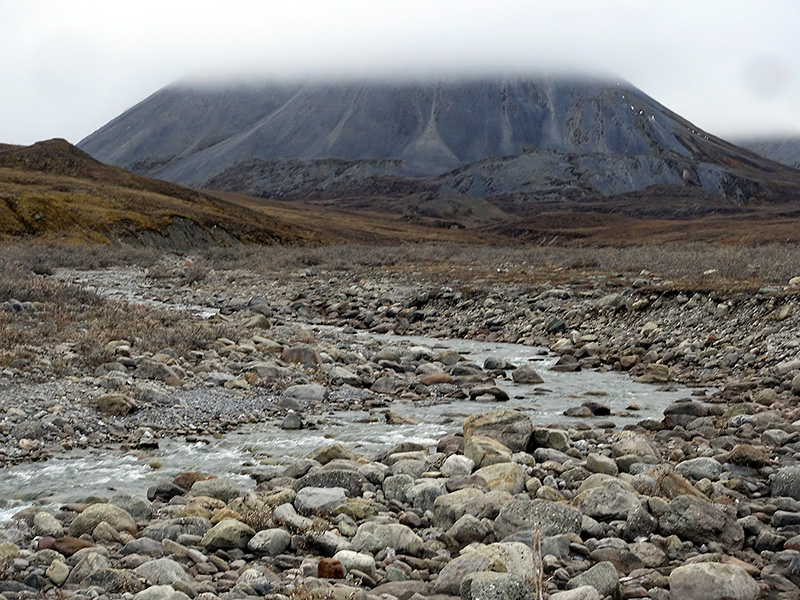
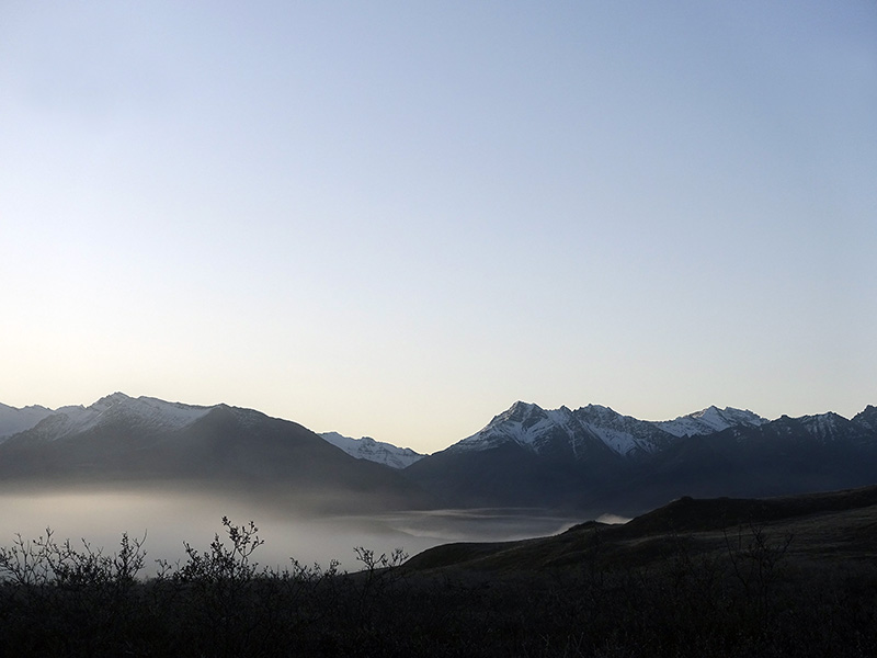
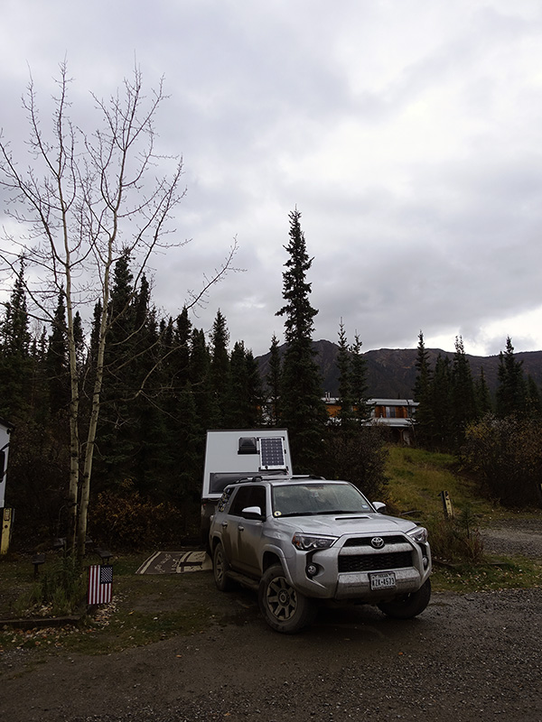
Woke up at 5 AM, cloudy, foggy, cold morning. The whole valley was fog-covered. After coffee, tea, breakfast, we packed and left our camp at 9:30 AM. We were the only ones who turned the north. Drove in heavy fog on, the bumpy, slippery, muddy, Dalton Hwy mostly dirt road to Milepost 98, Finger Mountains, where we stopped, hiked in strong wind, but the wind took away the fog and clouds, we had sunny day after that. At Milepost 115 we stopped at the Arctic Circle, then stopped at Gobblers Knob and Graylin Lake, where we got a nice view of the mountain ranges and to Koyukuk River. Continued on Dalton Hwy to north and Milepost 175 we arrived to Coldfoot Camp, stopped at the Interagency Visitor Center, where we got useful information for the camps and road conditions. Got gas at Coldfoot Camp, then drove 5 more miles north to Marion Creek camp, where we set up our Titan for the night. Drove back to Coldfoot camp for dinner, working on files, but my try for internet access was unsuccessful. Around 10 PM, drove back to Marion Creek camp. We were tired from the challenging today’s drive but we were happy. Starry cold night, 32 oF, the moon came out behind the mountain around midnight and stayed low, bright full moon, we did not see the Northern Lights.
Day 66 (Friday): September 13, 2019
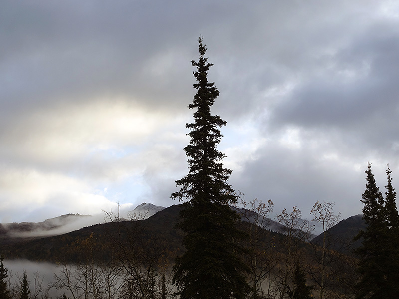
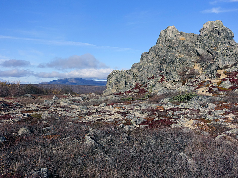
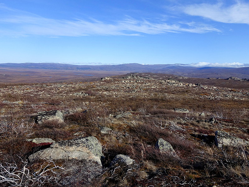
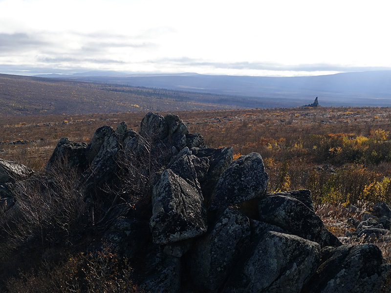
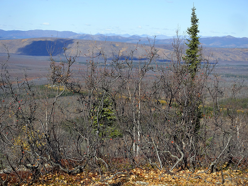
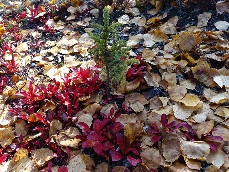
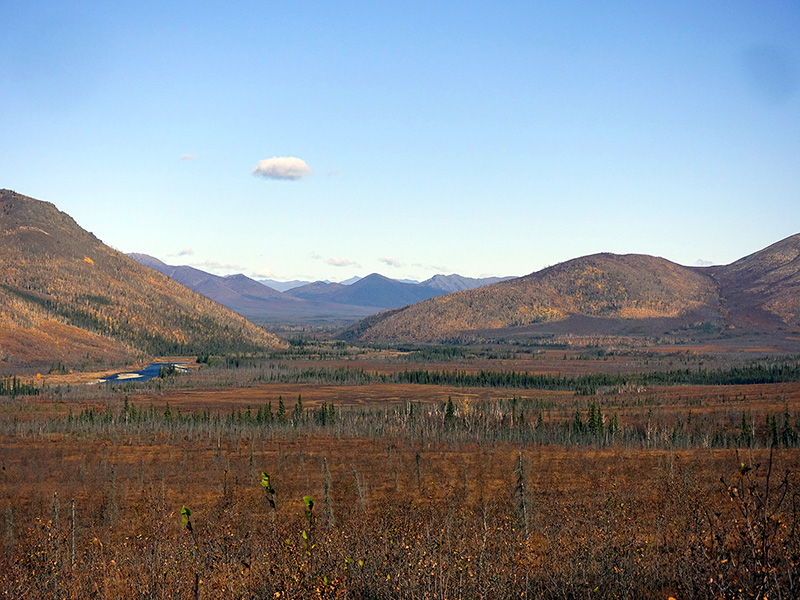
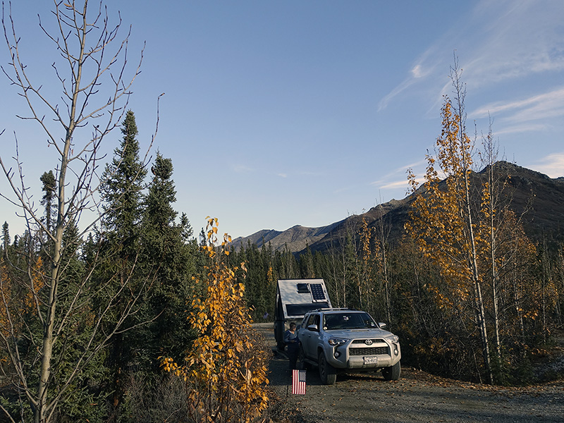
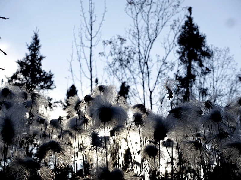
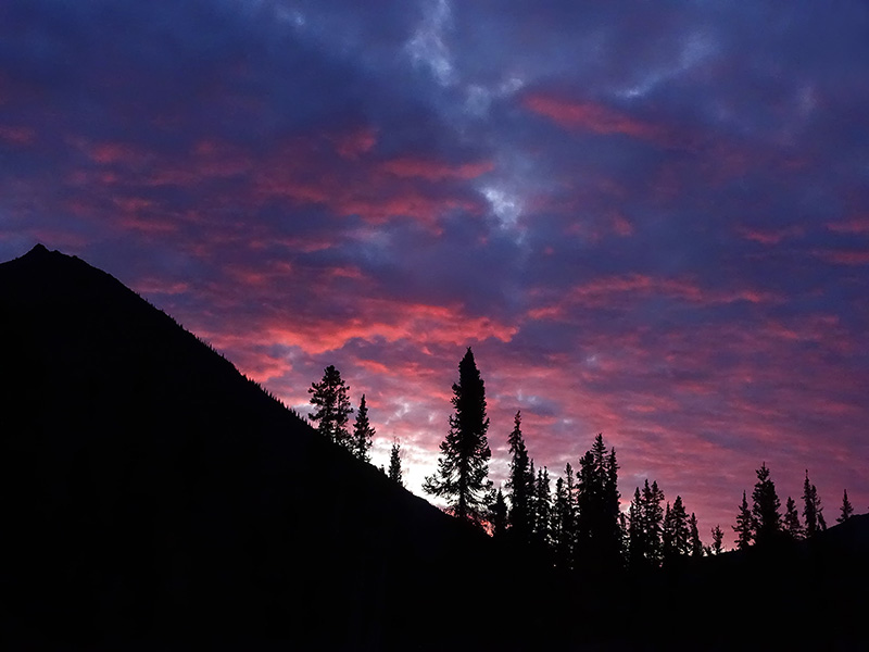
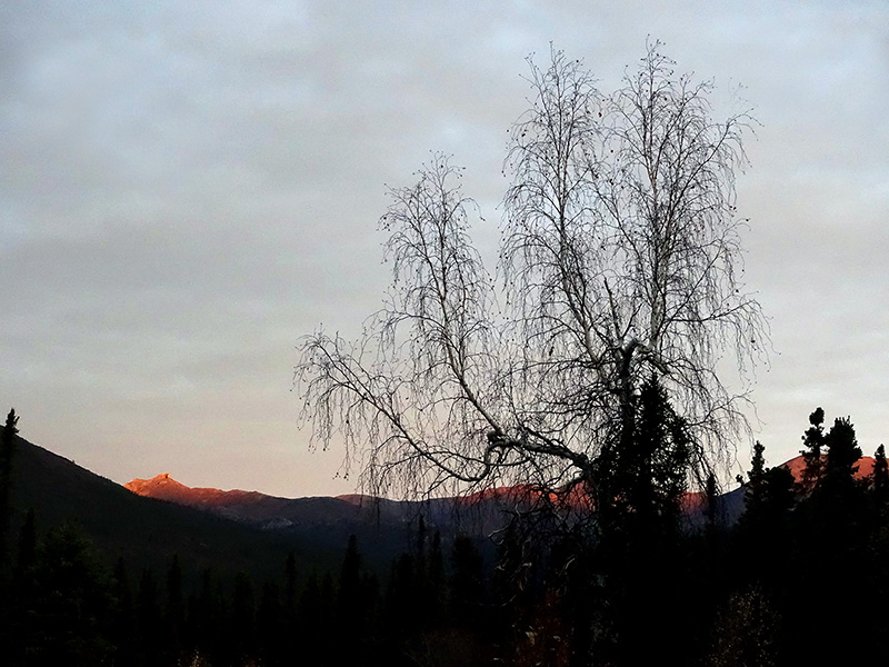
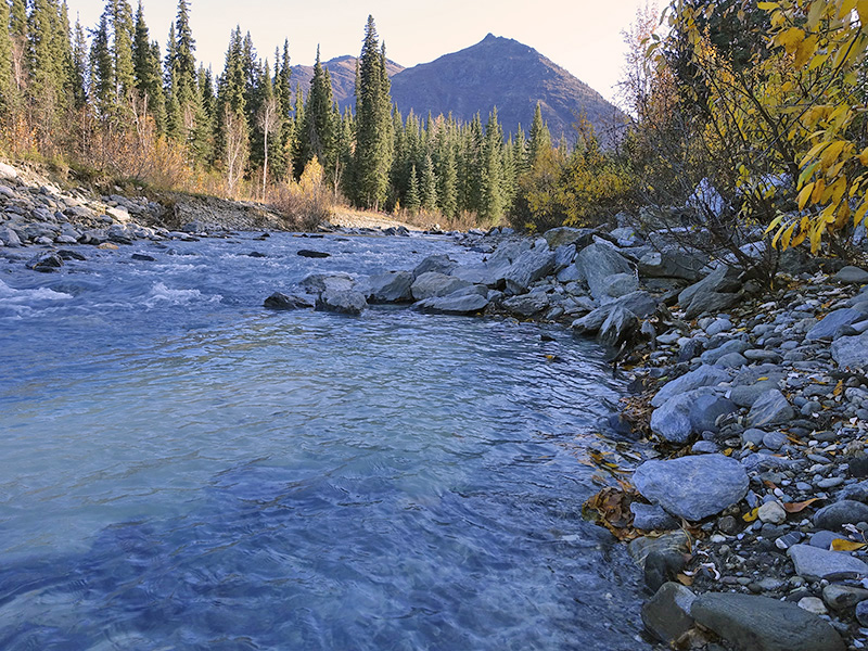
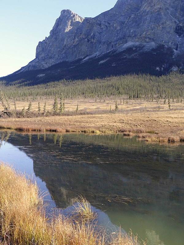
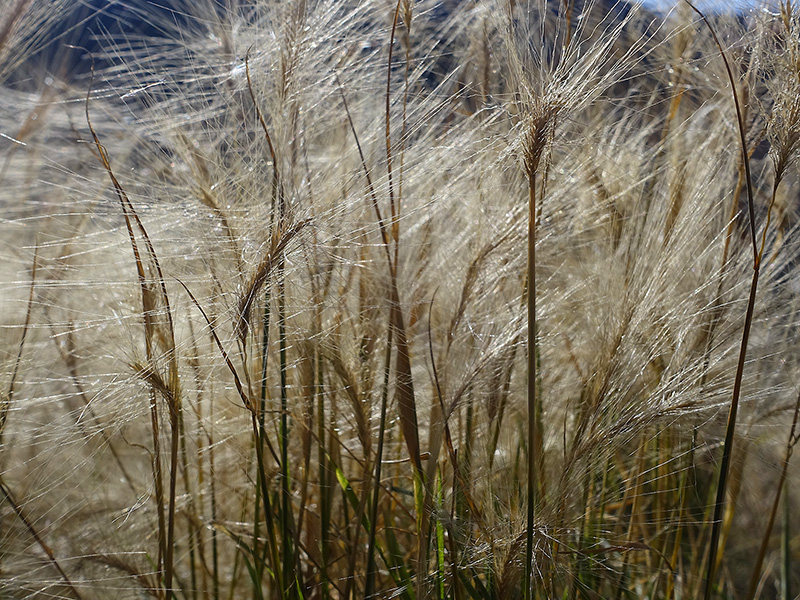
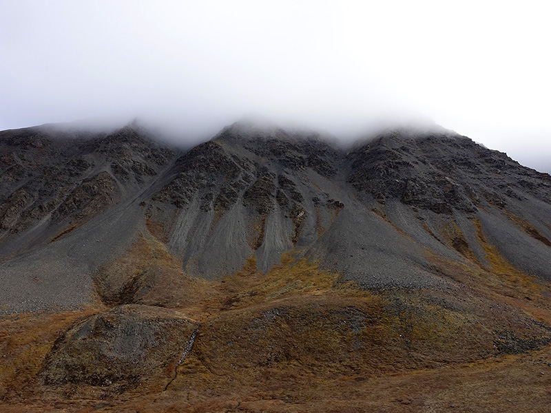
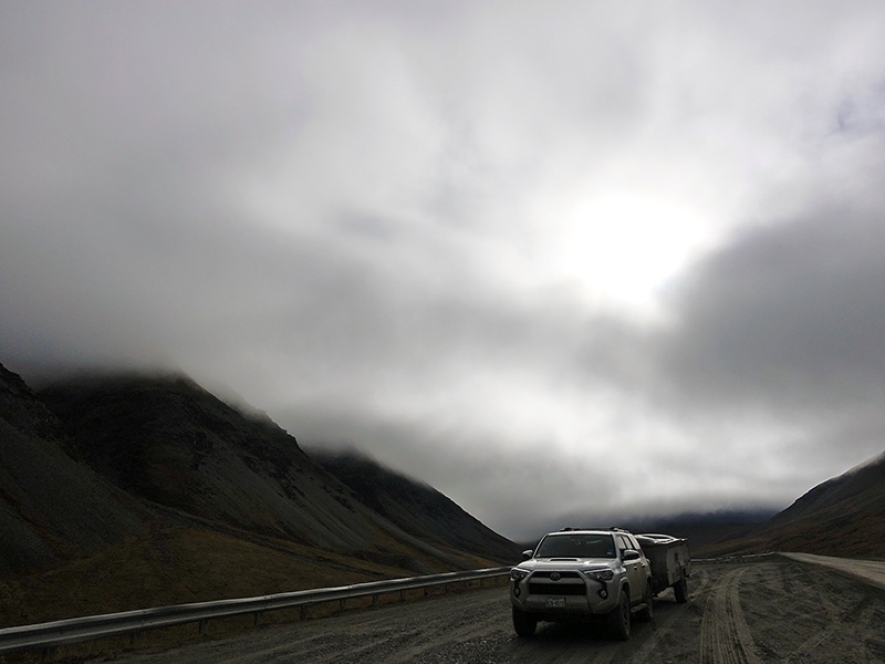
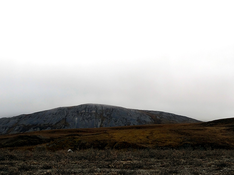
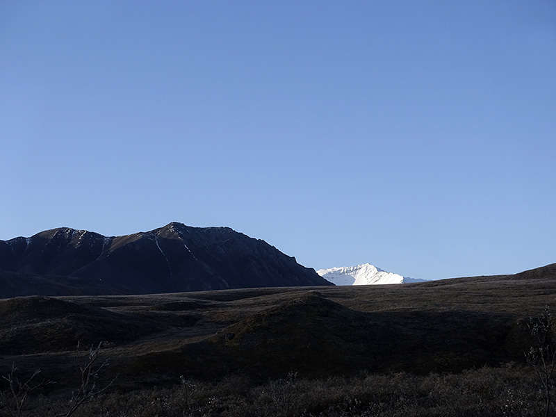
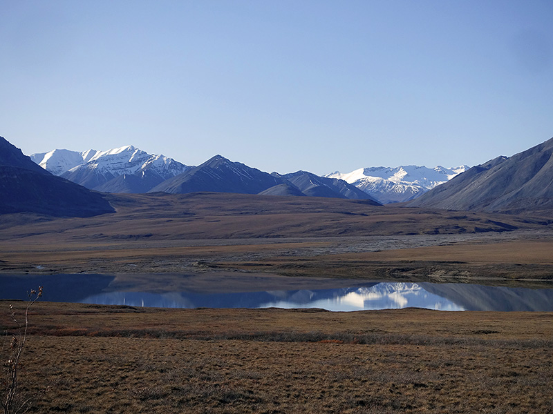
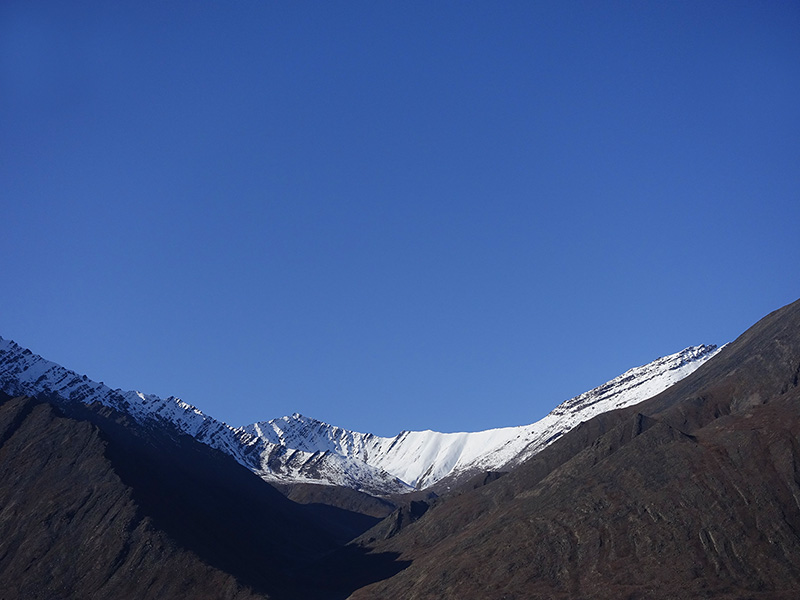
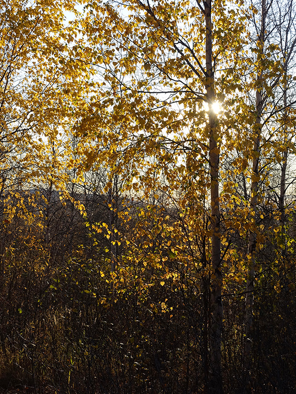
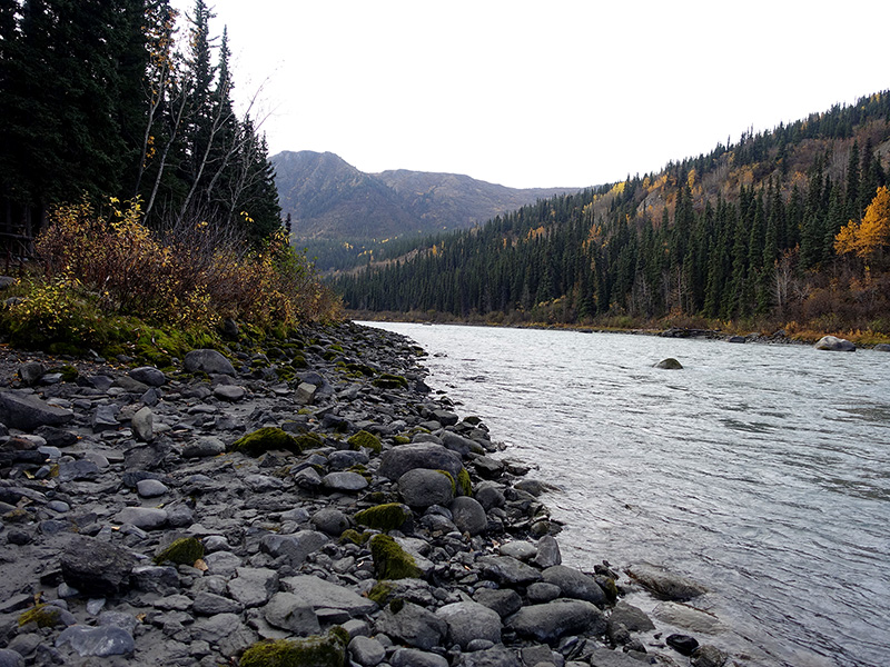
Woke up at 5:30 AM, got up at 6 AM, warmed up our tiny house, cozy, we like it. Walked around the scenic, surrounded by mountains, forestry camp, strong tundra on the ground. The rising sun behind the mountains, painted the sky and clouds pinkish. Peaceful, quiet time, took few photographs and walked with my camera for about an hour. The south side was cloudy, 38 oF cold morning, the north side looks like clear, we may get a sunny day. After coffee, tea, breakfast, broke our camp and continued to drive on Dalton Hwy to the north. Stopped at Sukakpak Mountains where small lakes were in the foreground, took a few nice shots with 4×5, reflecting the mountain on the water surface with floating grass and dried grass in the foreground. Continued on Dalton Hwy, stopped at the Farthest North Spruce site, then drove on the steep long slope to Chandelier Shelf, then drove up on a steep dirt road to Atigun Pass at elevation 4739 ft, arrived in the dense fog covered summit… then ascended on a muddy, slippery, steep, lengthy dirt road. We looked back at the first pull-out and were amazed by the beauty of the halfway fog-covered mountains, west side is part of the Gates to the Arctic National Park, the east side is part of the Arctic National Wildlife Refuge. Slowly descended farther on muddy sections filled with potholes and bumps covered dirt road, then arrived at Milepost 275, where we drove on a bad condition dirt road to Galbright Lake BLM free camp, in the Gates to the Arctic Preserve. Dense fog covered the mountains around us. A creek ran next to us. The north side of the Atigun Pass area is always challenging because that area is cold and foggy most of the time. At 9:30 PM started to darkening and at 10 PM was completely dark… every day is shorter by 8 minutes during this time of the year. Cold, 35 oF, no wind, no stars, foggy. We will not see the Northern Lights tonight for sure. Ate yesterday’s leftover for dinner, read books, worked on images and journal. Quiet, nice, relaxing evening, good night-sleep.
Day 67 (Saturday): September 14, 2019
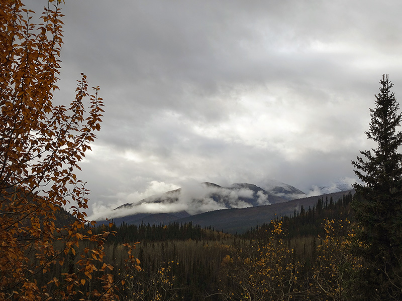
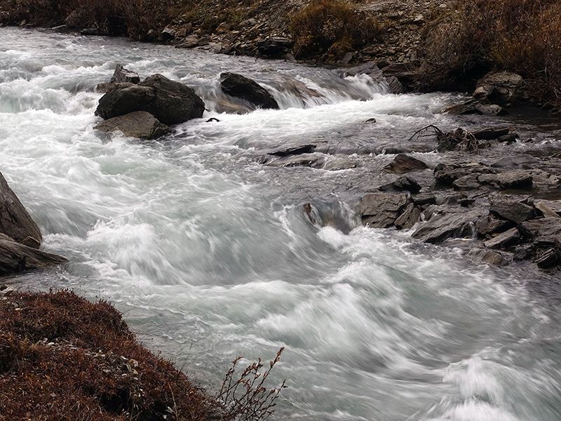
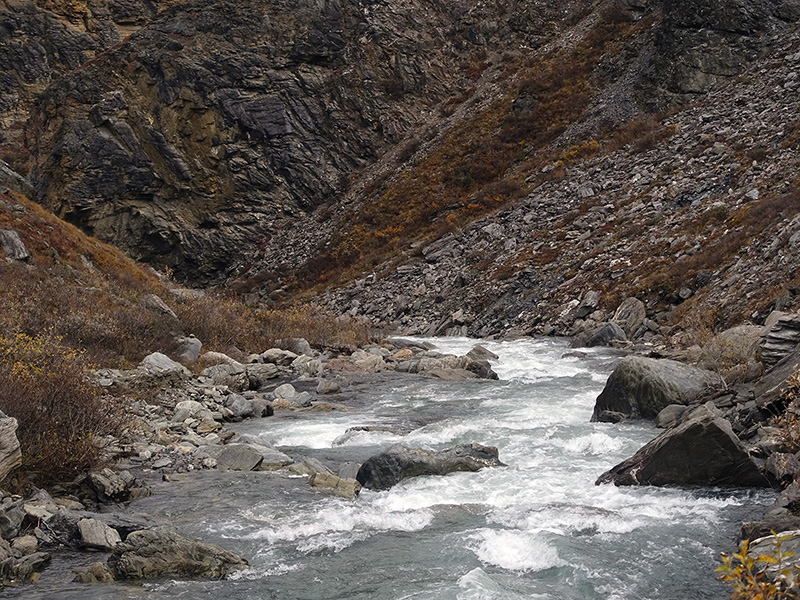
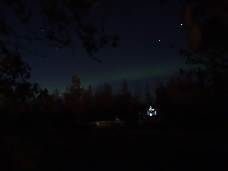
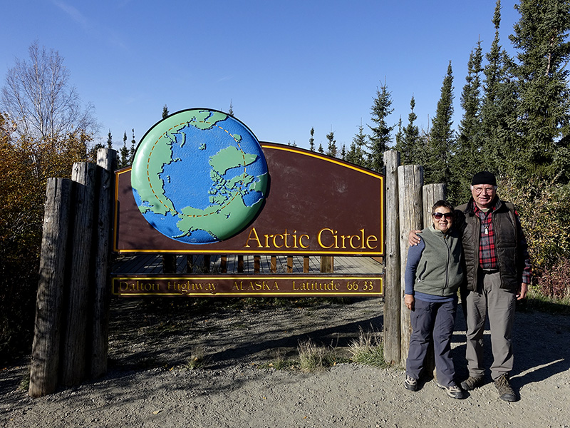
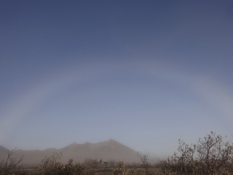
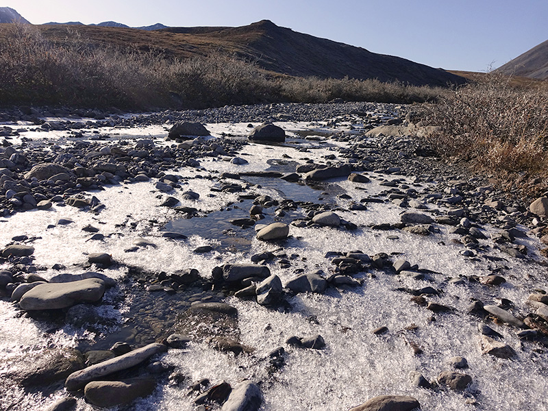
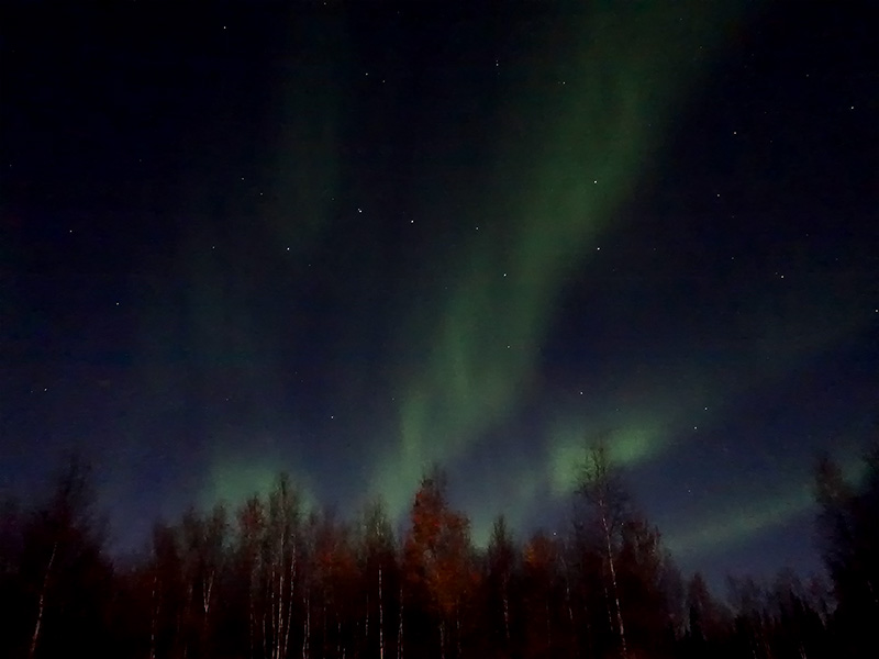
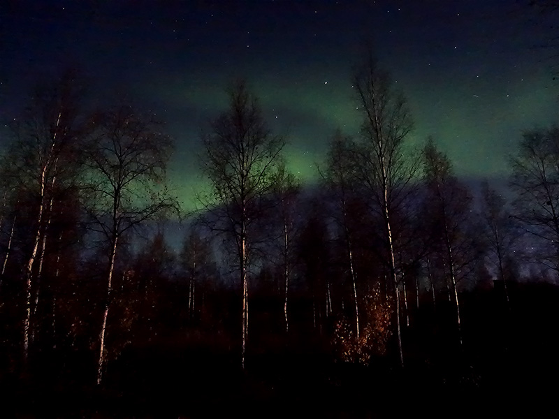
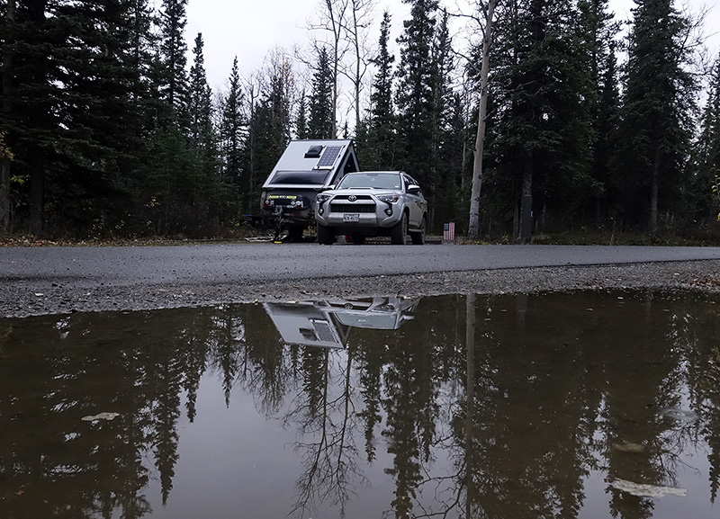
Woke up at 2:30 AM, full moon was visible through the dense fog, the green strip of Northern Lights was barely visible through the fog, but I felt its presence. At 4:30 AM, the fog changed and started to move to the leg of the mountain, leaving the top uncovered, and the full moon was in fog above the mountain. I missed the photo, but at least I saw it, and I will never forget that mysterious appearance and arctic beauty. Got up at 7:30 AM, 23 oF, cold enough… but we were in the north side of the Brooks Range, which is always cold and foggy this time of the year. The Sun slowly moved out behind the mountains and gave special lights through the fog. The mountains around us were snow-covered. Lexi spotted a full arch of “fog-rainbow” at the west side, it was very pale in color, lasted about 20 minutes. We were blessed to be able to see, these special arctic gifts from nature. After breakfast I took few large-format photographs, then packed and left. A slow-running portion of the nearby creek was partially frozen. It was beautiful, I washed my face in it and touched the arctic ice. Drove on Dalton dirt road from Galbright Lake to Atigun pass, then to Chandelier Shelf then back to Coldfoot. Got gas and good soup for dinner, then continued on Dalton Hwy to Arctic Circle, where we set up our Titan and camped. Walked around the camp trails, enjoyed the sunset, then ate a good dinner and worked on our images and journals. After sunset, the temperature started to drop, at 10 PM we have 45 oF, dark now and the stars and constellations are well visible. We are hoping for the Northern Lights. What a day! We not just passed the Arctic circle twice, we even spent a night there.
Day 68 (Sunday): September 15, 2019
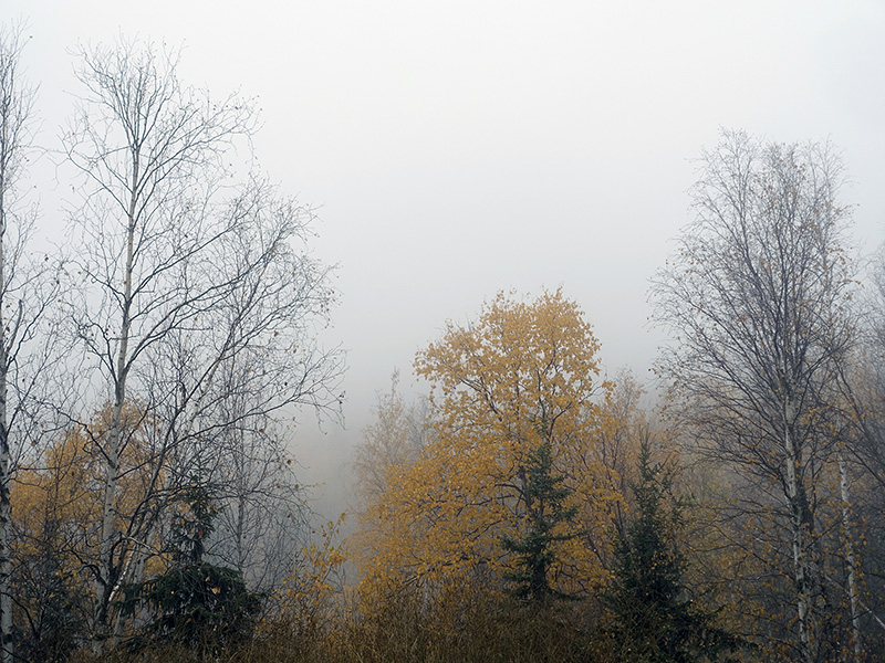
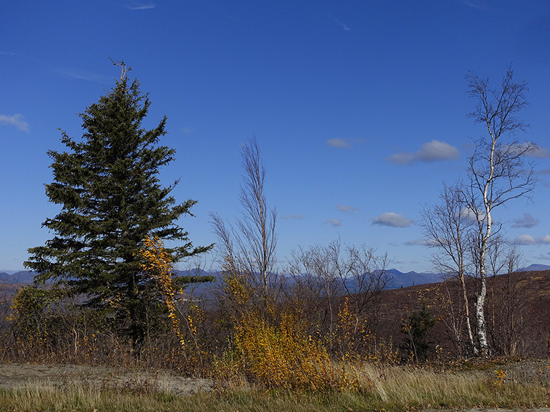
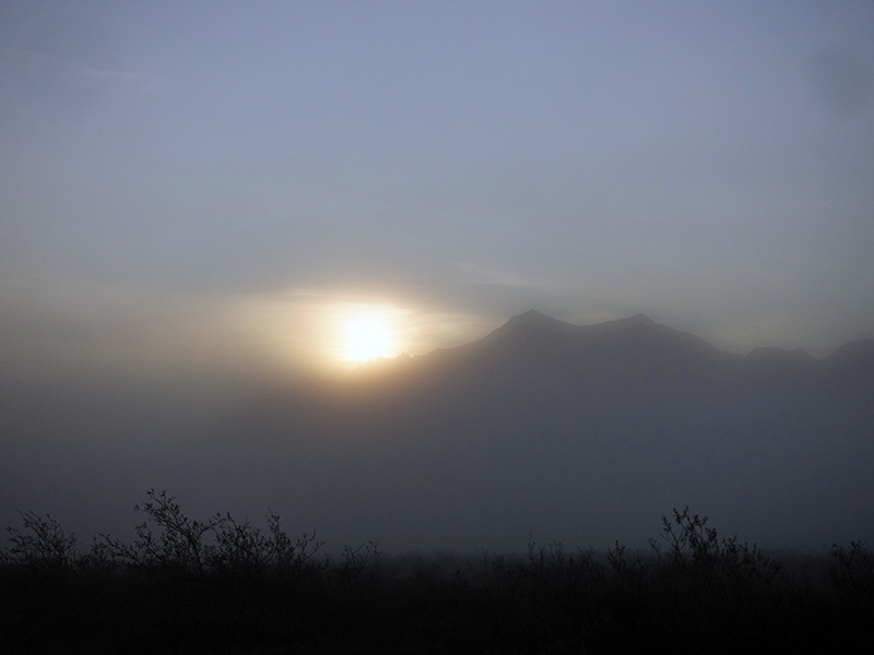
Woke up at 6:30 AM, the sky started to be pinkish, then the clouds turned pinkish before sunrise at the east side, however, later, the west side lower clouds started to be pinkish, contrasted with the grayish upper clouds above them. Took few pictures from the early morning magic, which was an additional gift to the Northern Lights at night. The full moon was low, and dropped some light to the trees at night, causing special foreground effect to the Northern Lights. Around 7:30 the sky paled out, no more before sunrise magic. After coffee, tea, and a slow breakfast, started to pack and left the Arctic Circle around 10 AM. Drove on Dalton Hwy south, took a final look to the Finger Mountains, then to the Yukon River. Continued on Elliott Hwy to Fairbanks. Checked out several RV parks, but all were closed for the season, stopped at Walmart Super Center, bought some supplies then drove to Denali Grizzly Bear camp, few miles south to Denali NP. I was tired after this long challenging drive on the final part of the Dalton dirt road, then on the steep-sloped curly Hwy 3 to Denali. After setting up our camp, around 9:30 PM, we ate a good dinner from yesterday’s food, then Lexi started to wash then dry all of our dirty clothes. She finished at 1 AM. Cloudy rainy night, no visible stars, and no visible Northern Lights. Worked on files and Journal, we are tired but happy. We had a very good day.
Day 69 (Monday): September 16, 2019
Got up at 6 AM, cloudy sky, still raining. After our morning routines and hot shower, working on files then ate a good breakfast, then checked out at 11 AM. Drove to Denali National Park. Arrived at Riley Creek Camp, went to the Camp Check-in and they told us no spots available, just from tomorrow. We made the reservation and were ready to boondocking somewhere nearby, but we checked the camp and found several empty spots, talked to the camp host and we got one for tonight and we had one for tomorrow and after that, the camp is free because they close the water and we will return to the primitive camping as we did many times and were happy. Set up our Titan and drove around on Denali National Park road up to mile 15, Savage River bridge parking, after that only Park Road permit lottery winners were allowed to drive. Turned back and slowly drove, looked for wildlife, explored the trailheads, and stopped at the Visitor Center and Book store where we always find something new to read. Started to rain again, then stopped, then rained again. We ate dinner, then organized, made new plans, and read books.
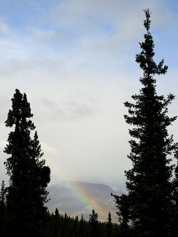
Day 70 (Tuesday): September 17, 2019
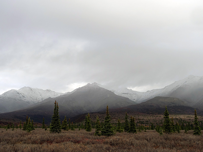
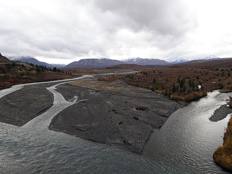
Woke up at 2 AM, cloudy, sprinkling, then at 5:30 AM rain stopped, cloudy, but the Moon was visible and high above us, as we use to see it. After bathroom, coffee, tea, breakfast, and small repairs on the trailer, started to drive on Park Road enjoying the cloud and fog partially covered, fresh snow-capped mountains and tundra vistas. Drove to mile 15, Savage River, where we set up for a 2-mile hike, carried my large format gear, and took few pictures. When we returned from the hike, rained again… drove slowly back, stopped many pull-outs, and photographed this beautiful land. We saw the Alaska Range and the 20,310 feet high Mount Denali from a distance, then the sun came out for a short time and as a special bonus, dropped a rainbow to the mountains. Around 4 PM arrived back at the camp then check out the nearby Denali Village, got gas and some goodies on the last day of the opening of the stores. Tomorrow everything will be closed for the season, the campground will be closed but we can stay there as primitive camp users. All services will be closed from tomorrow, we can enjoy the creek water and pit toilet and high likely only a few brave will stay.