Monthly Archives: September 2019

Naturalperl Epic Adventure Photography Trip Through the Rockies to Alaska: Week 12

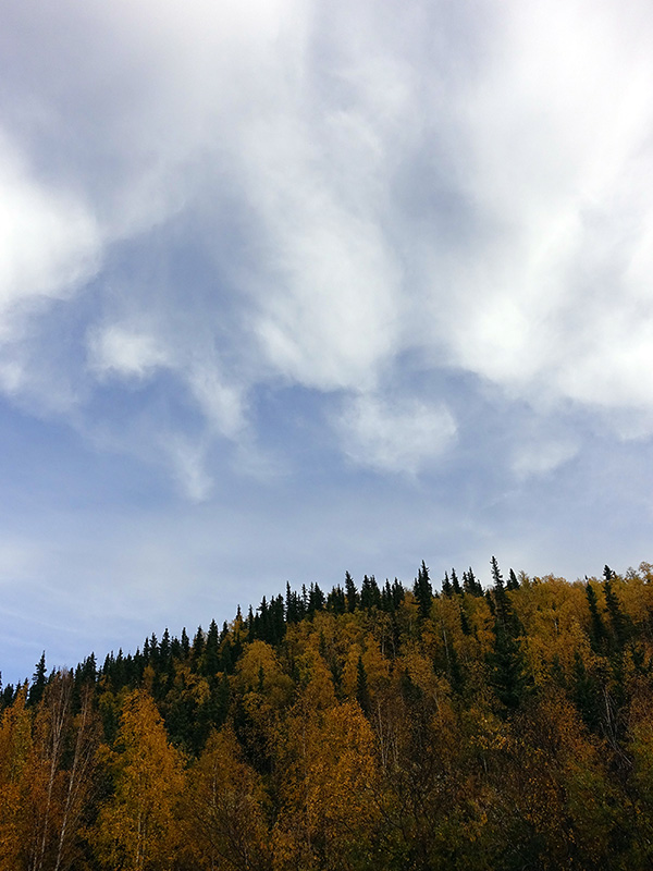
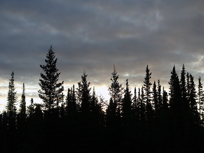
Day 78 (Wednesday): September 25, 2019

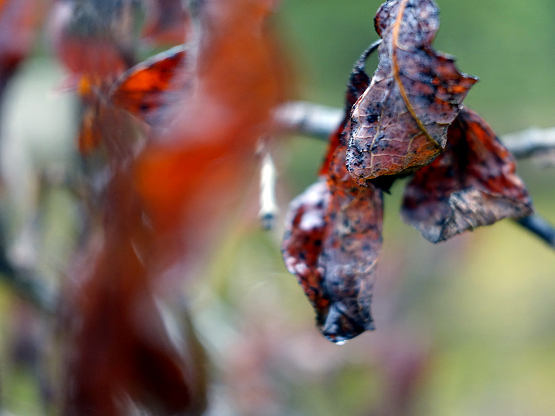
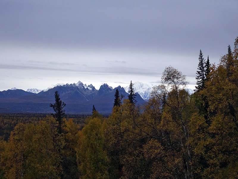
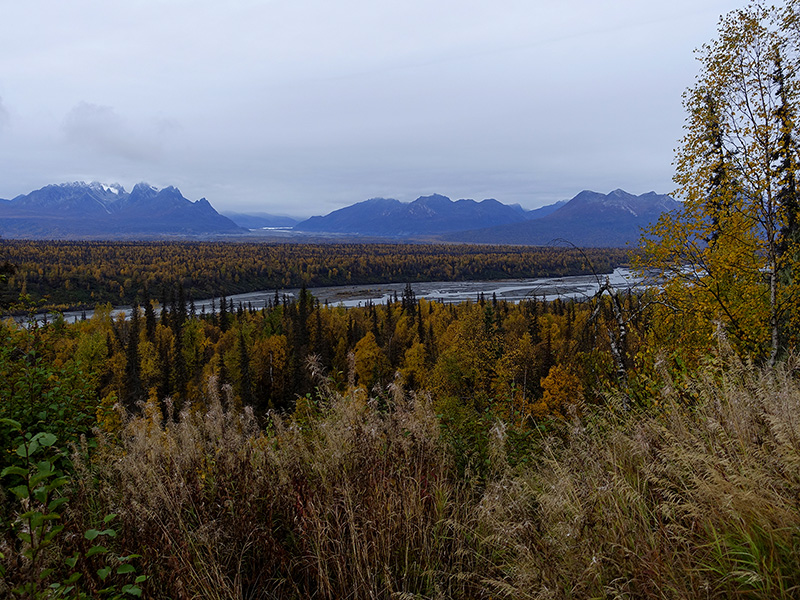
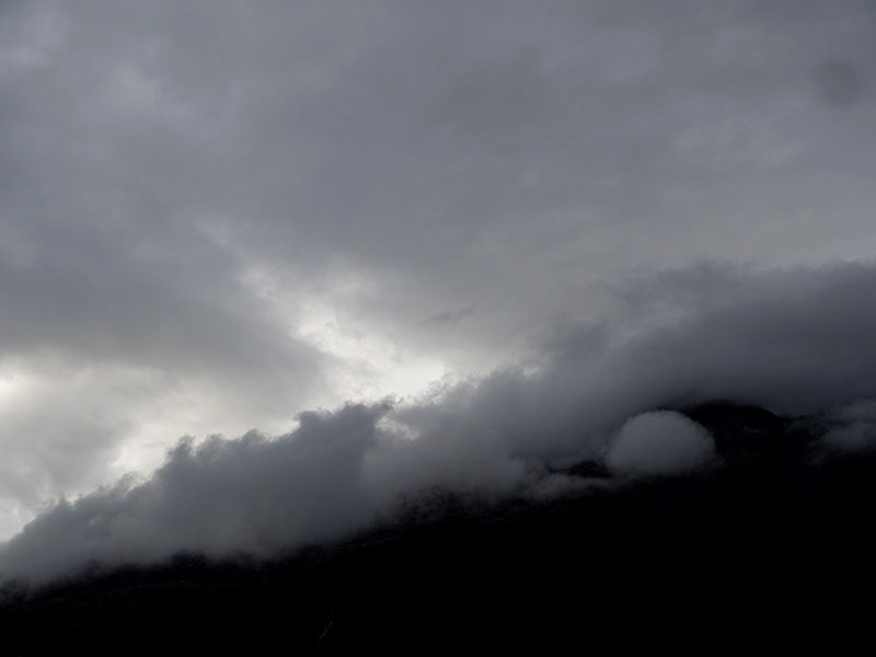
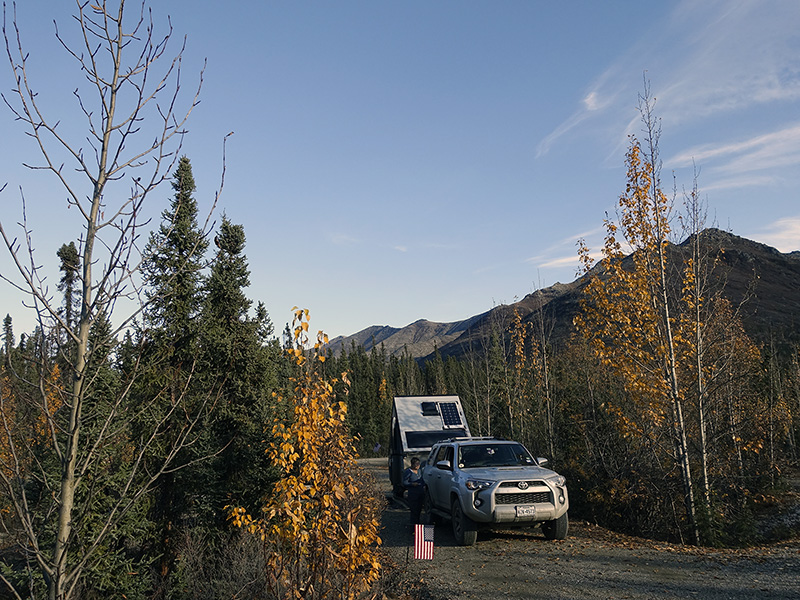
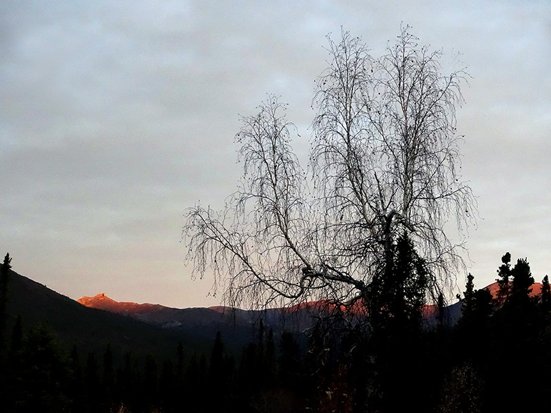
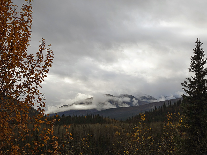
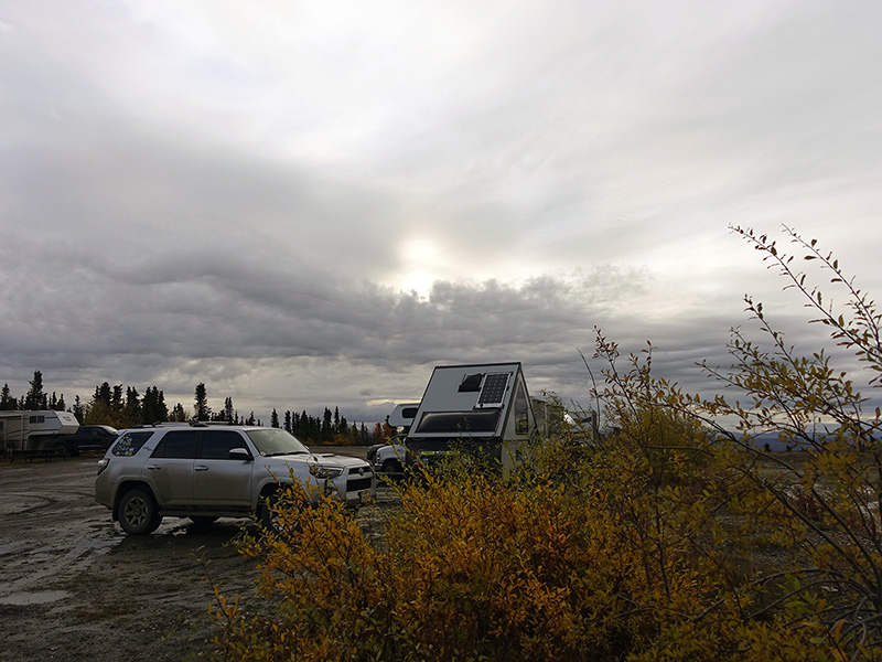
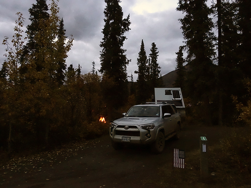
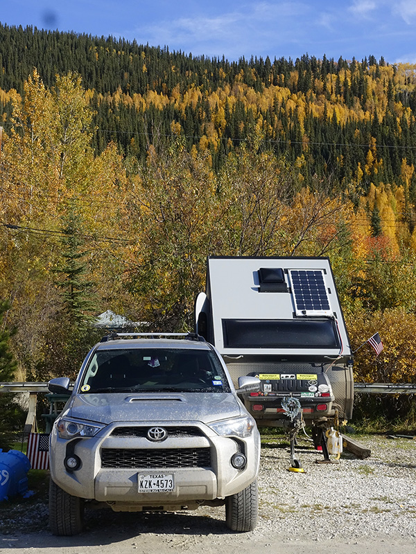
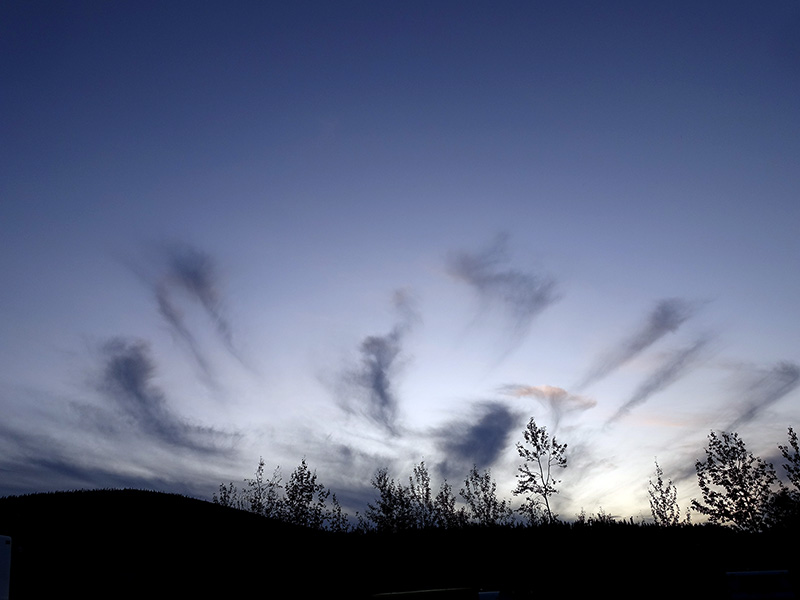
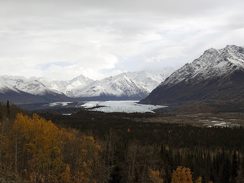
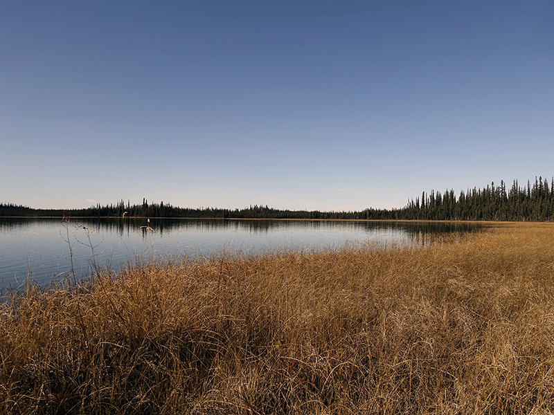
Got up early as usually every day, then after my coffee, tee, continued to work on our trip, organized and checked the campsite options for the next few days. The rain started… After breakfast, we packed and closed our camp, then drove in rain and slippery road to Eagle River, Eklutna, then to Palmet. Luckily when we arrived to the curly and steep mountain road sections, the rain stopped. Passed King and Sheep mountains, looked at the breathtakingly beautiful Chugach Mountains and enjoyed the huge Matanuska and Nelchina glaciers. After Mendelta, passed Tazlina Lake, then Tolsona, finally arrived to Glennallen. Loaded with gas and got few more missing groceries, then set up our Titan at Northern Nights camp in Glennallen. Well, the rain started again and just does not want to stop… I was tired after the long mountain road drive, we ate yesterdays leftover and worked on images, journal and read book, learned life lessons from the native. We had a beautiful day. 

Braided Chugach River and Nelchina Glacier far away
Glacier creek Mud patch
Mix of trees, mix of colors…
View to Matanuska Glacier
Sheep mountain

Day 79 (Thursday): September 26, 2019

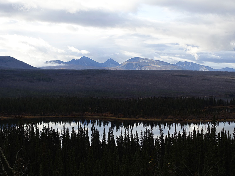
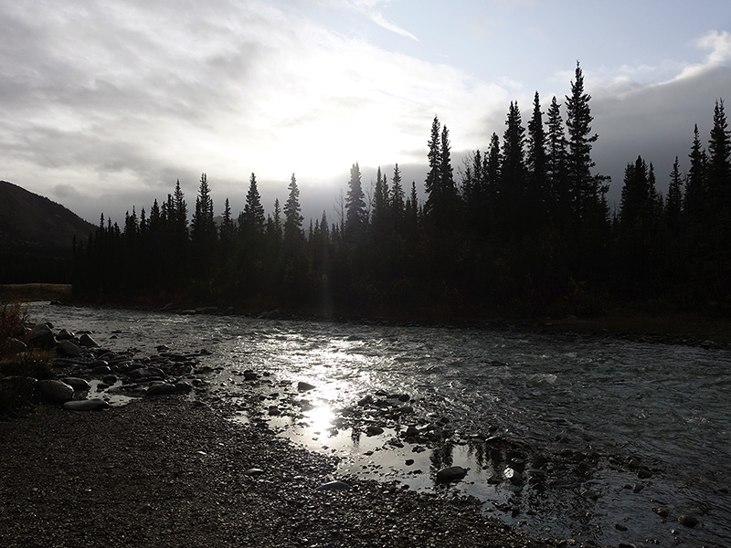
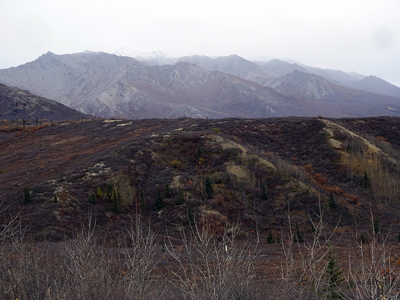
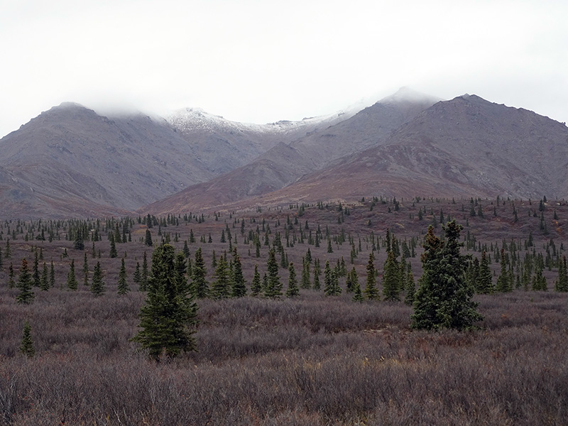
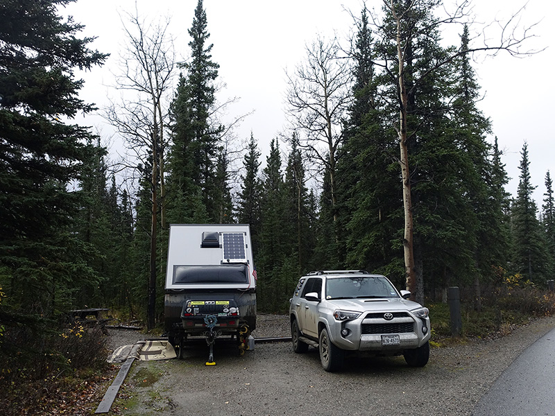
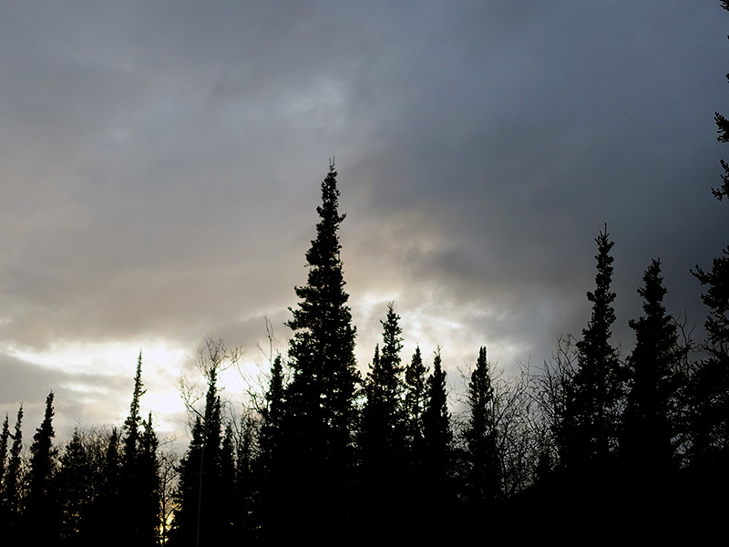
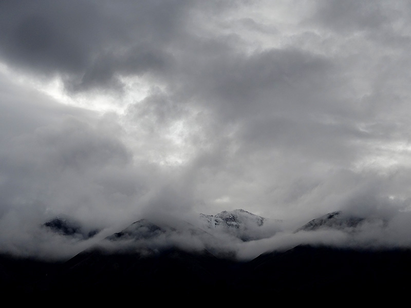
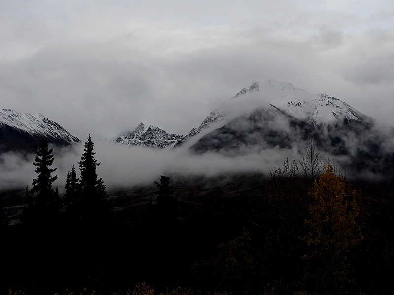
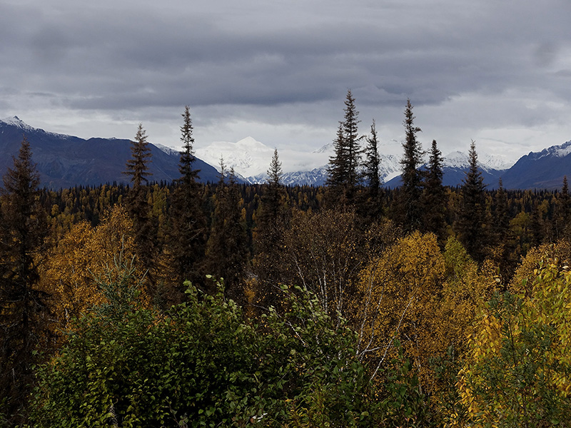
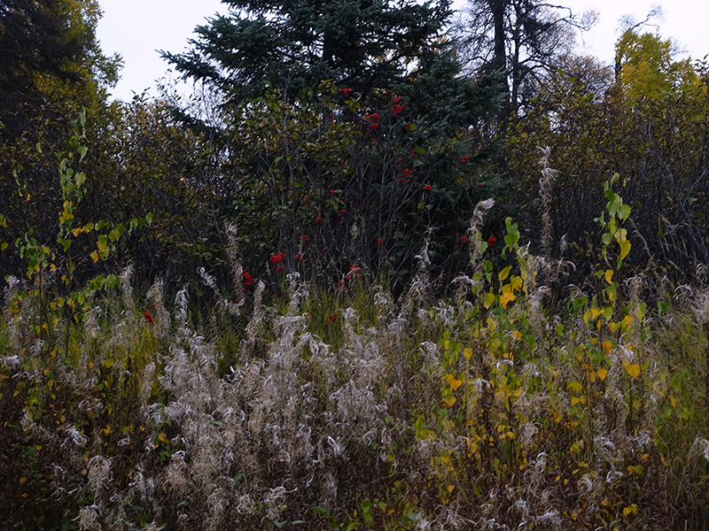
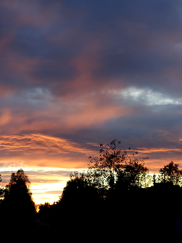
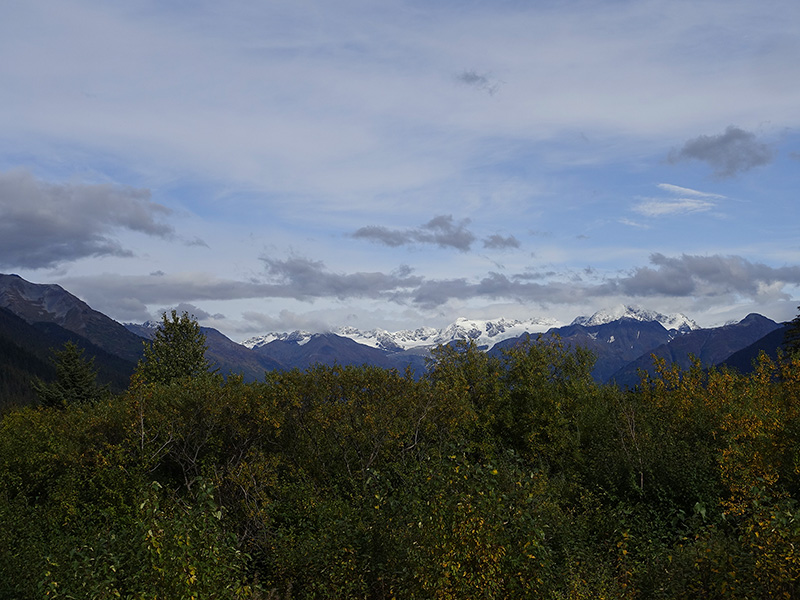
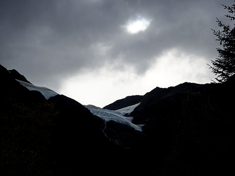
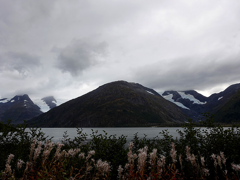
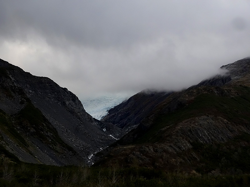
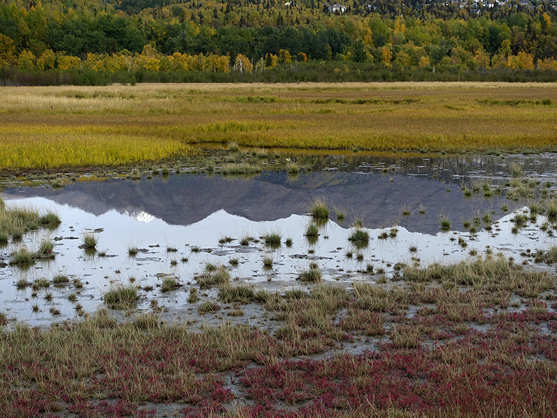
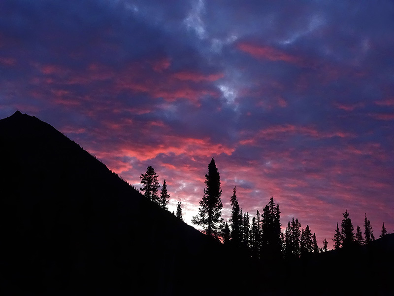
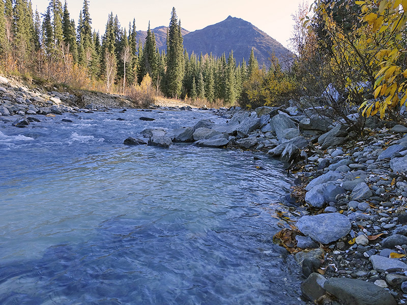
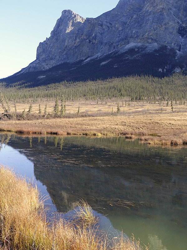
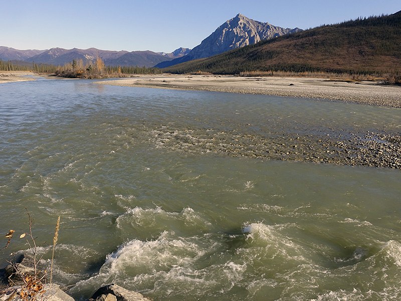
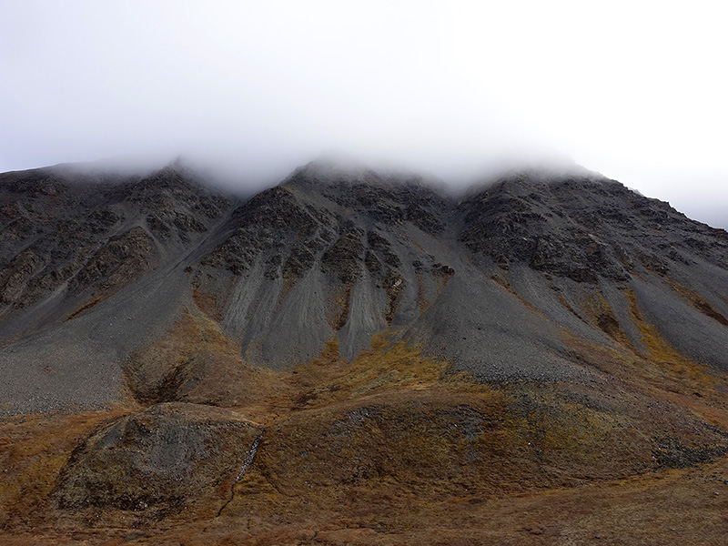
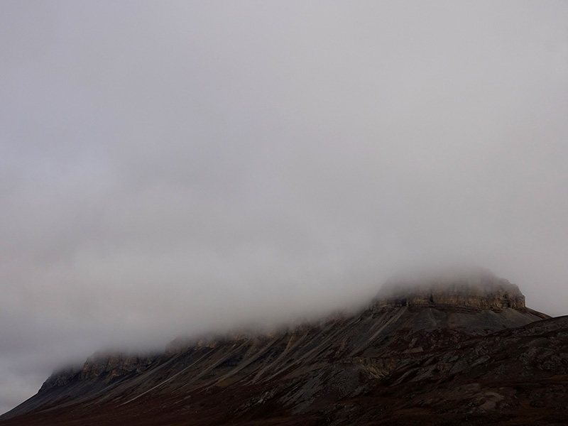
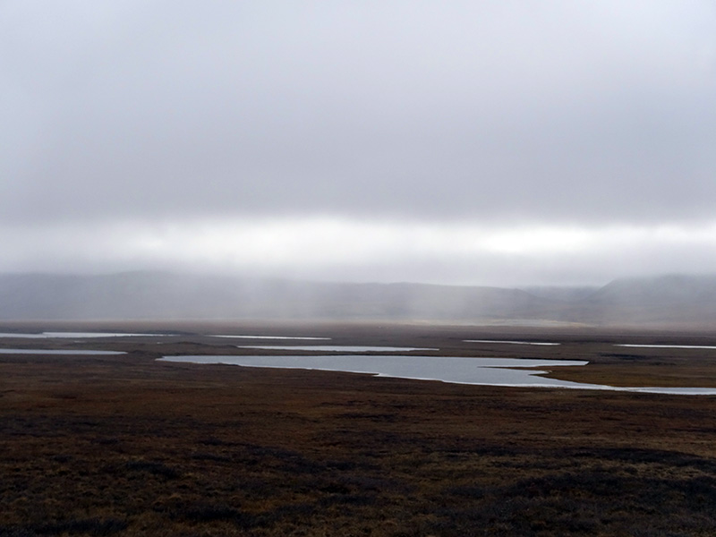
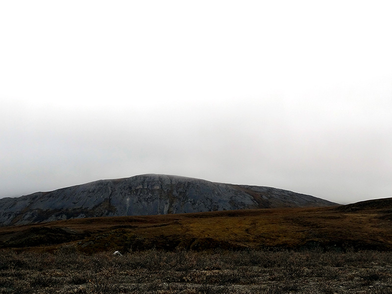
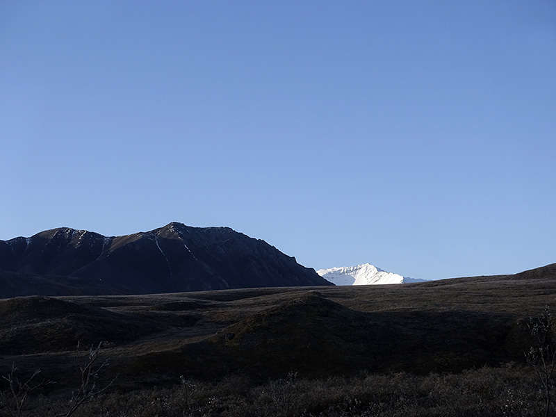
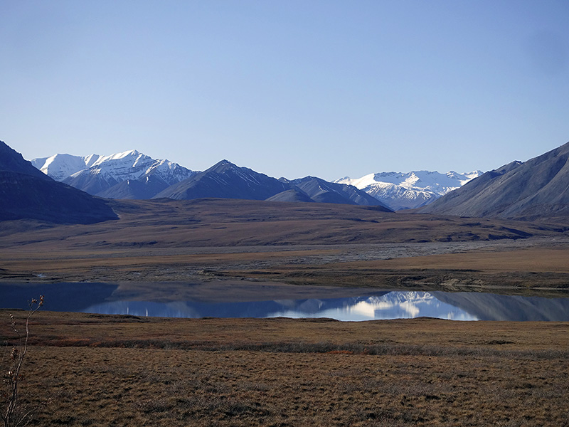
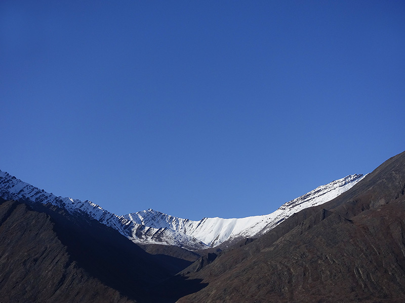
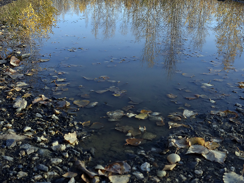
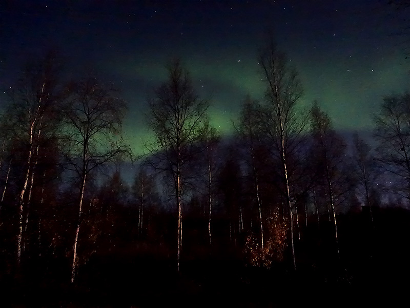
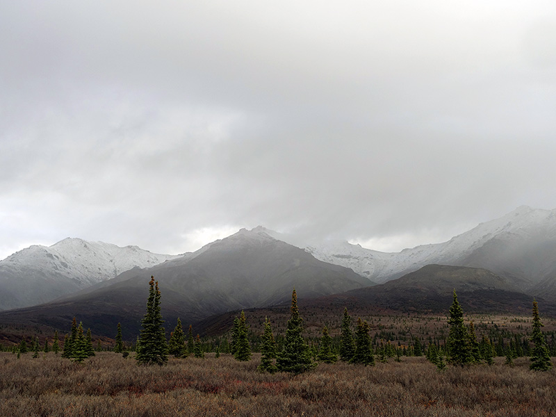
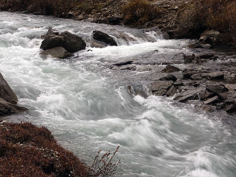
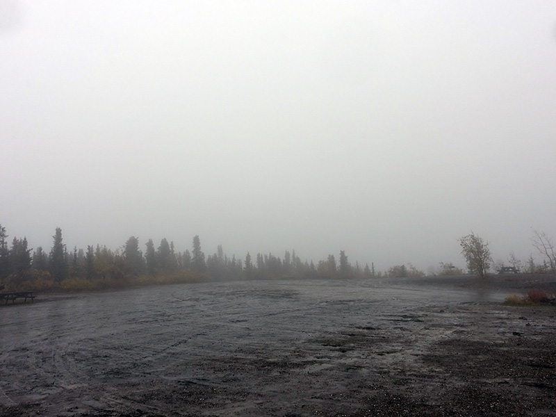
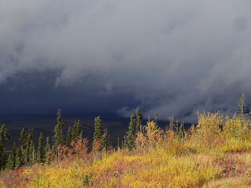
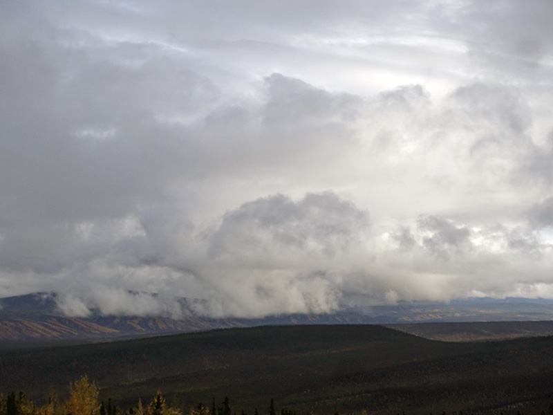
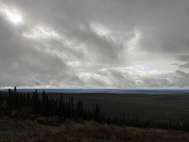
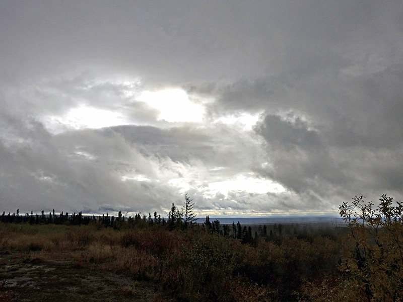
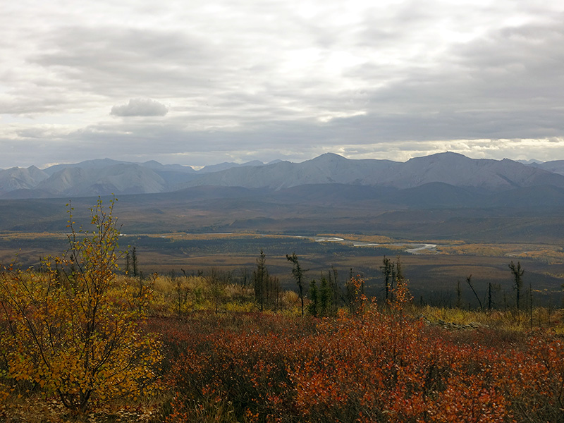
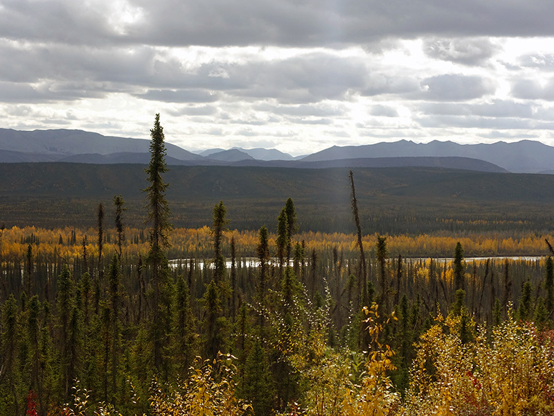
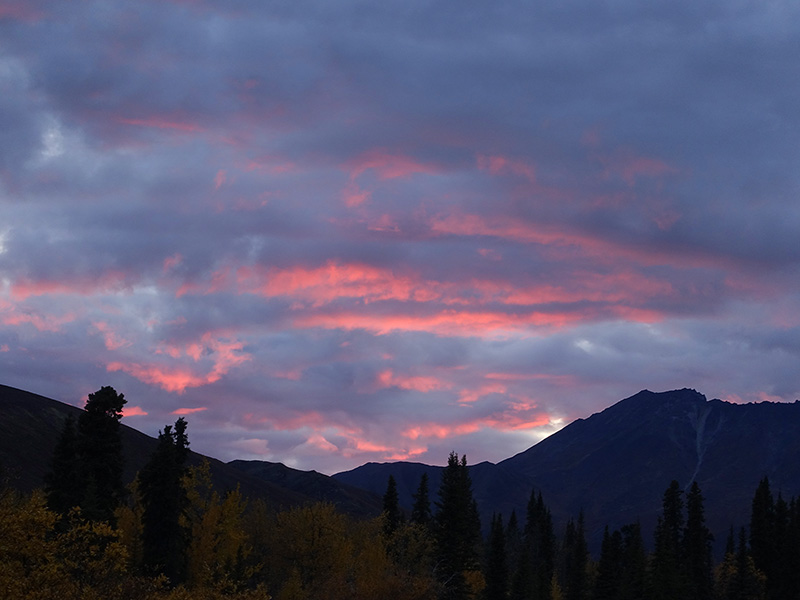
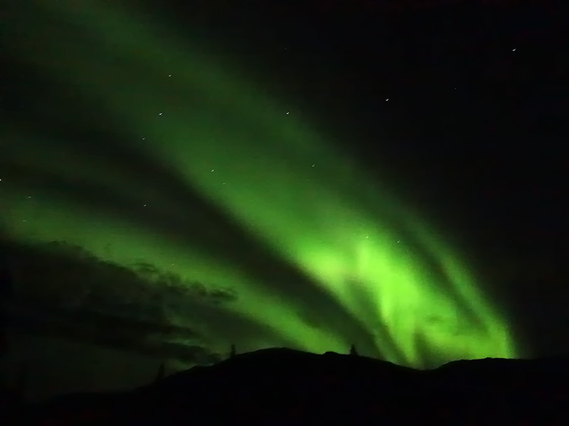
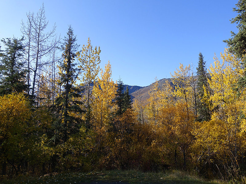
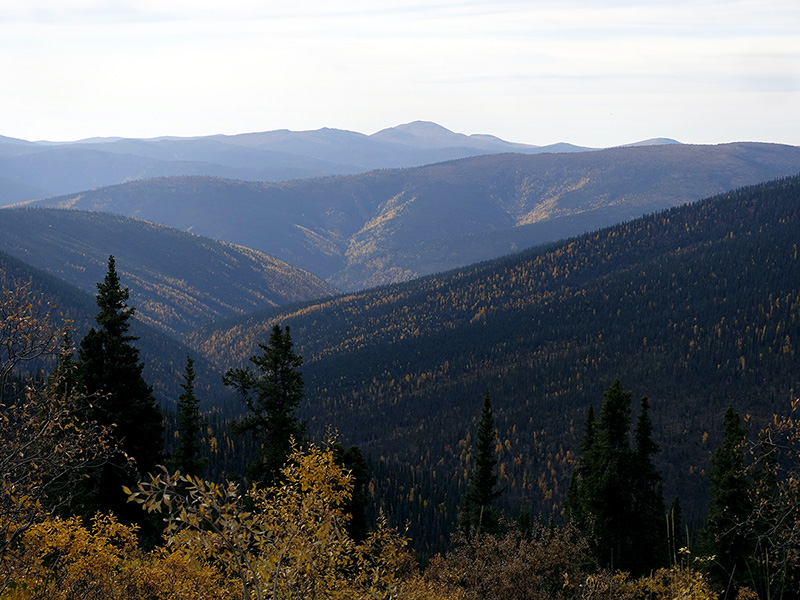
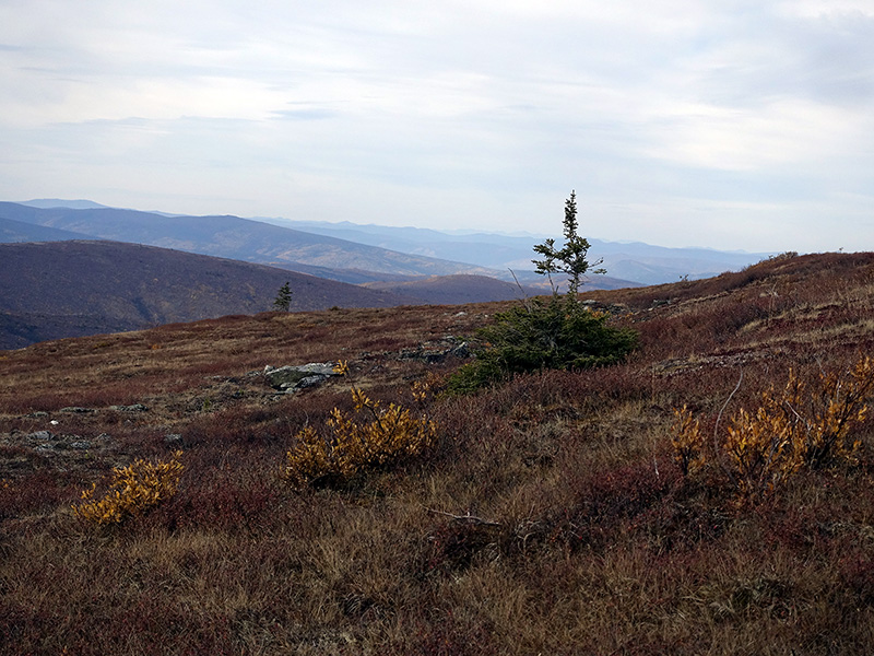
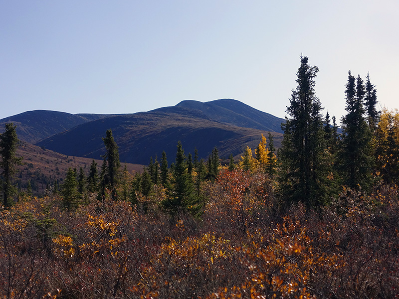
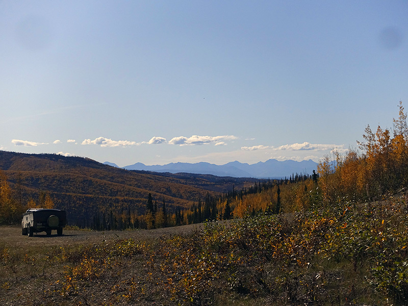
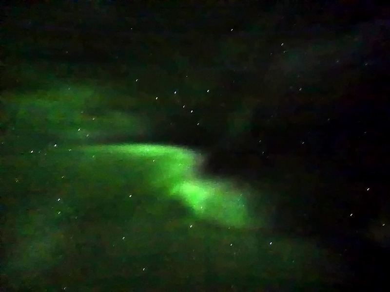
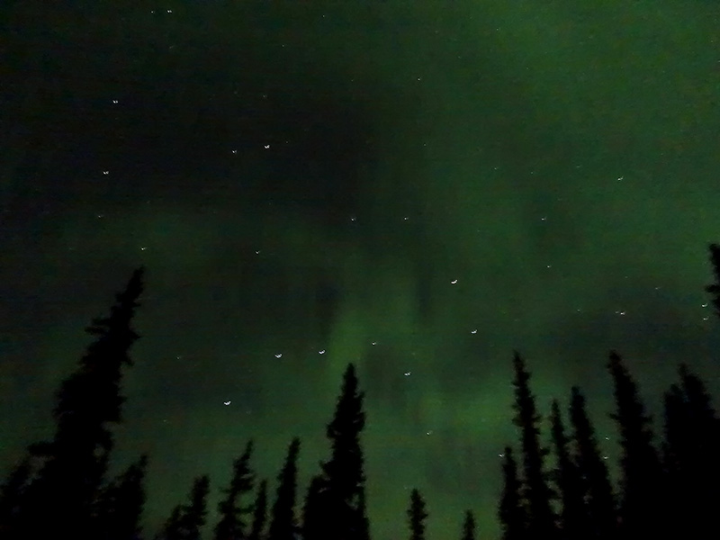
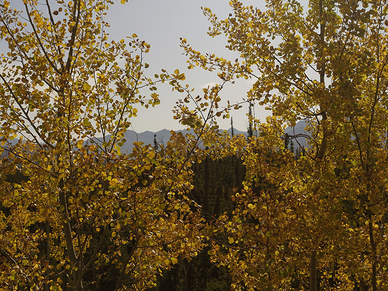
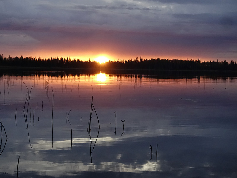
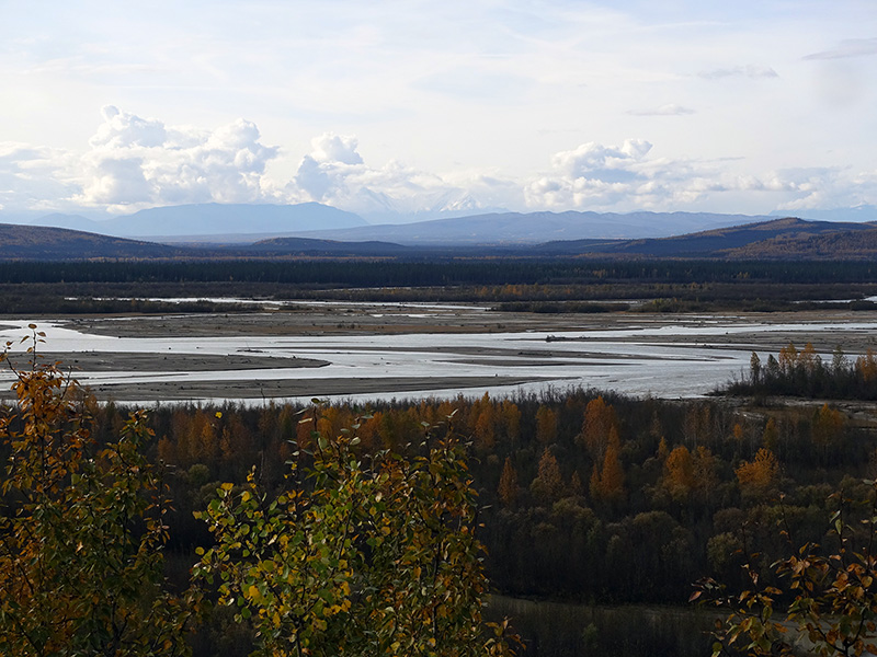
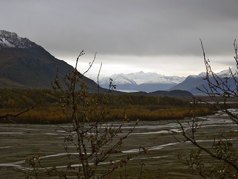
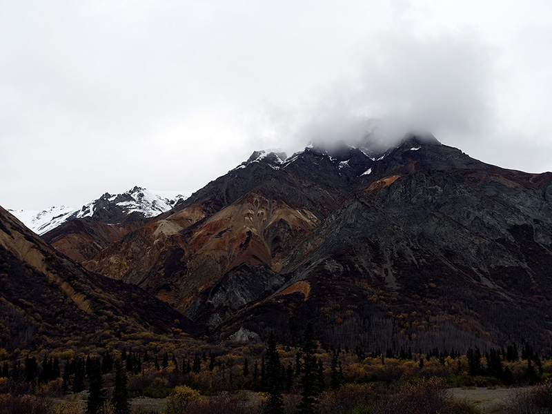
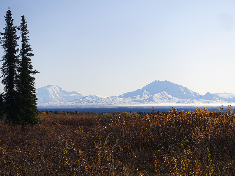
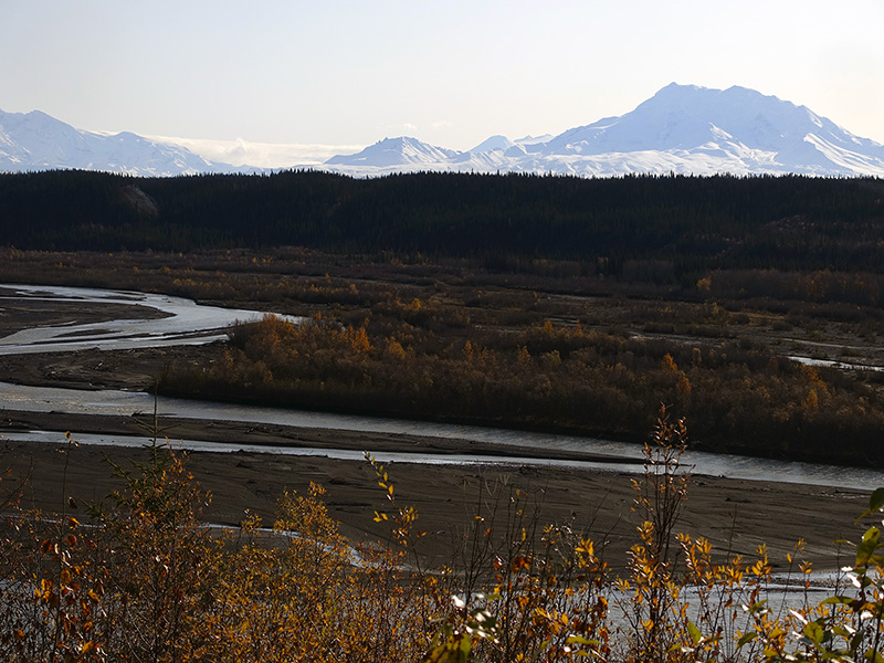
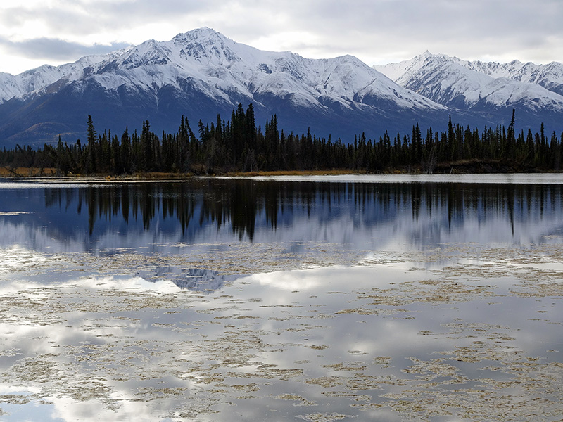
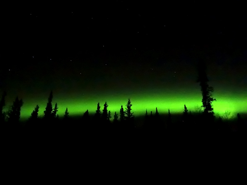
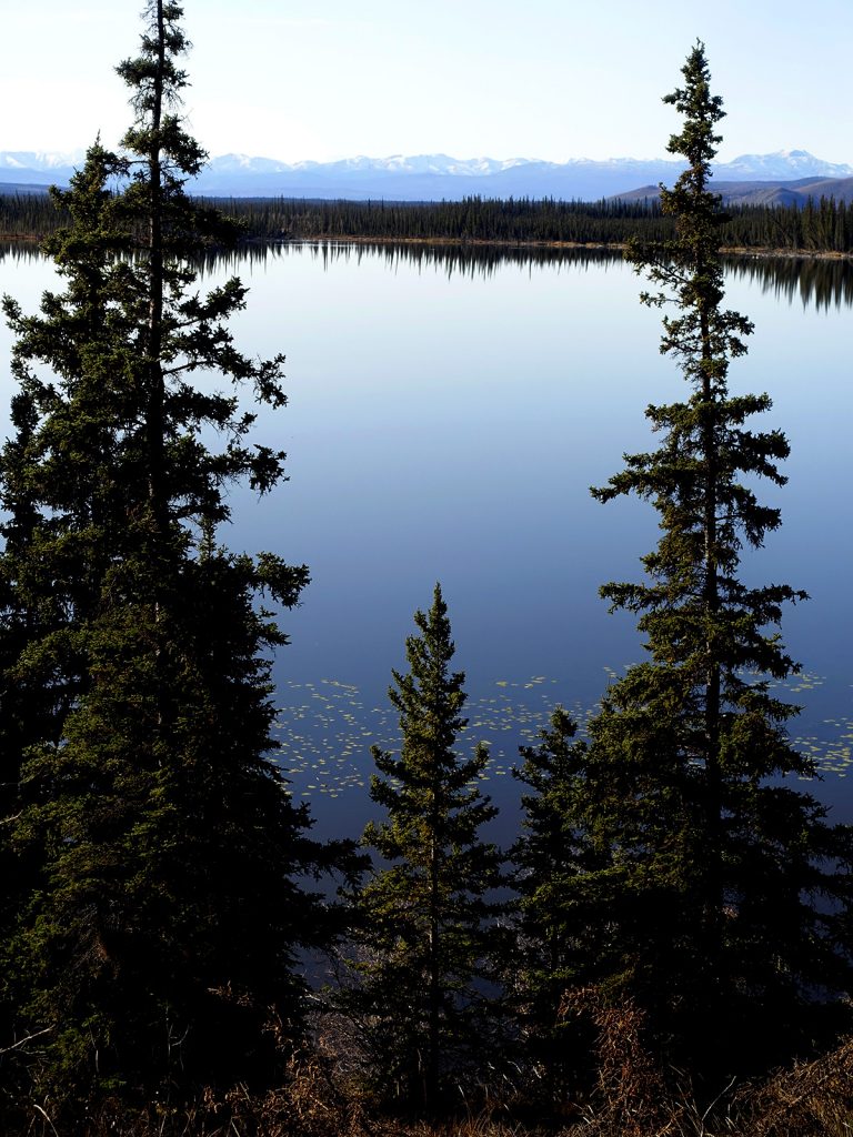
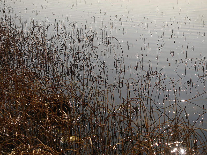
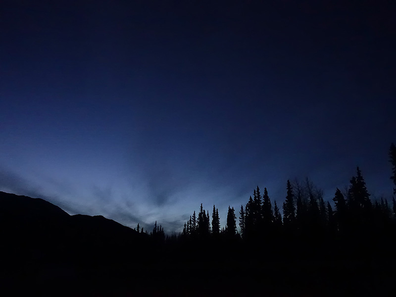
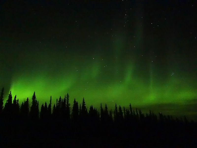
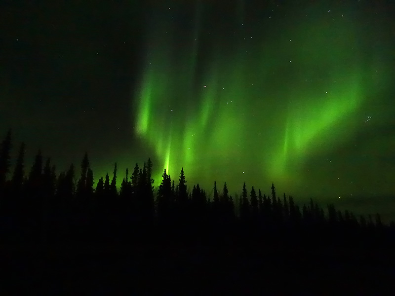
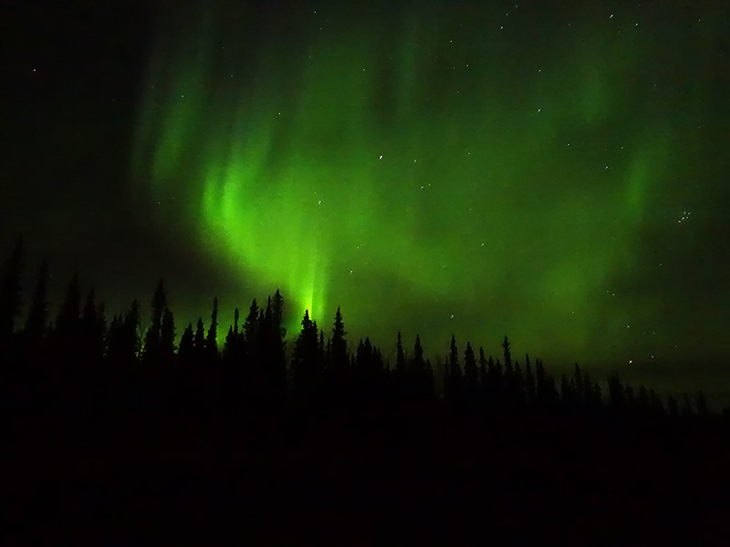
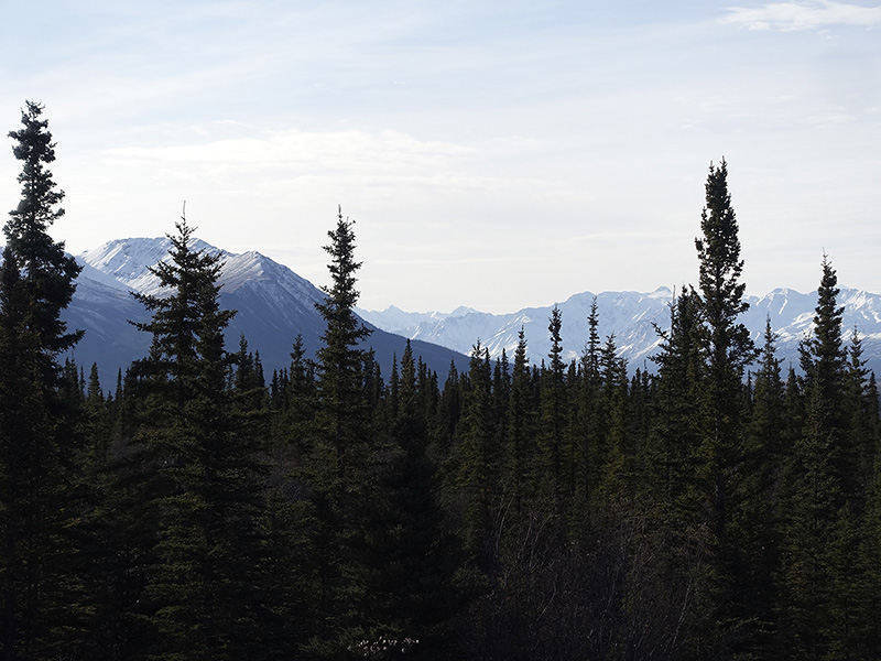
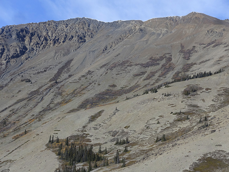
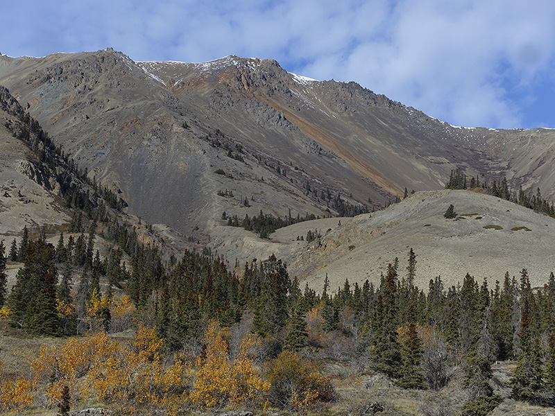
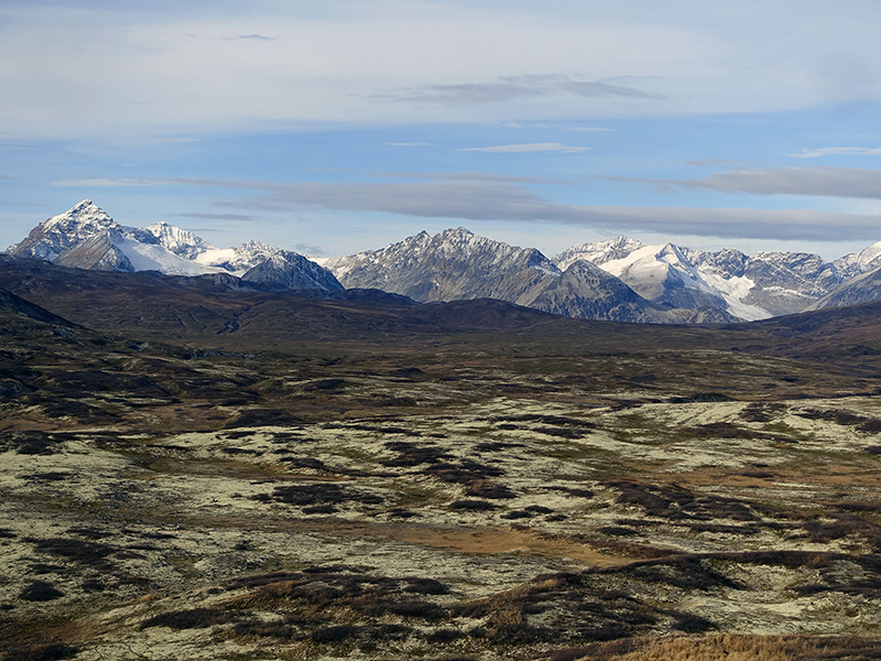
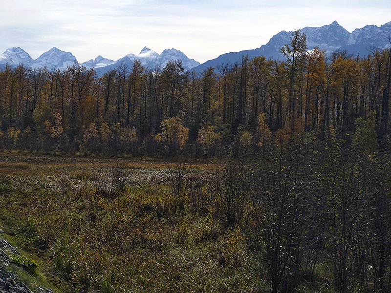
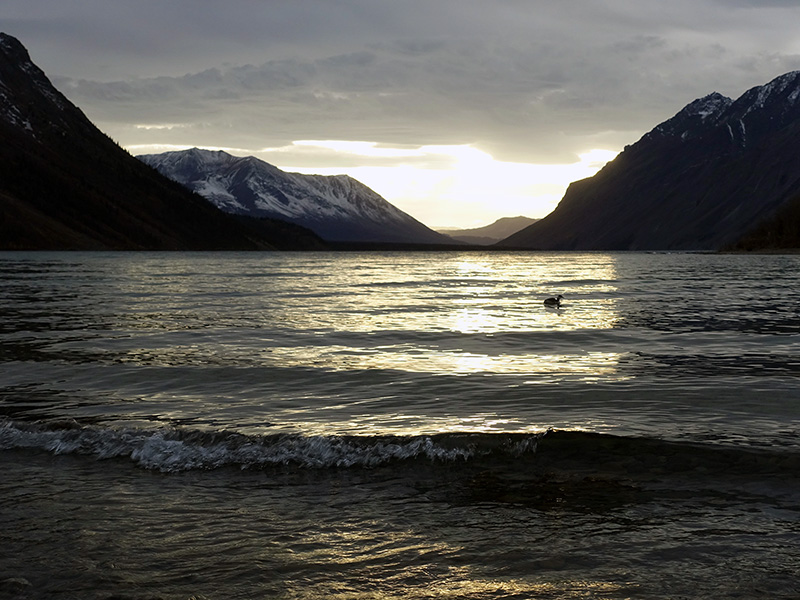
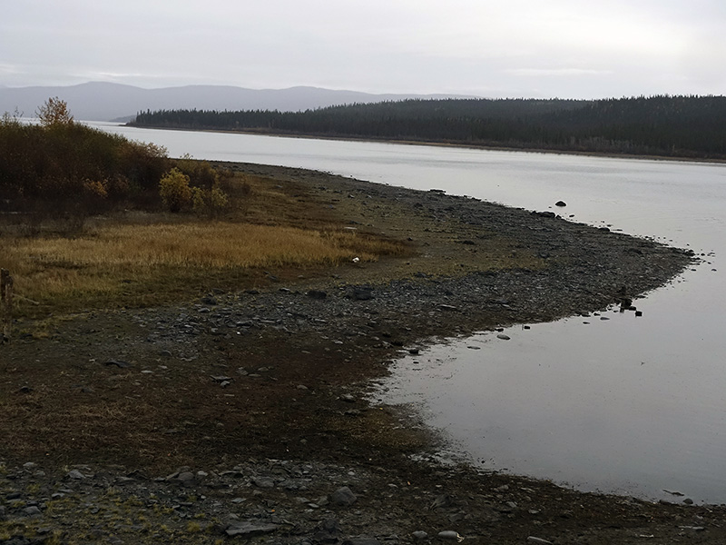
Got up early, the rain stopped, partially cloudy, cold, 35 oF, but we have a good chance to have good weather for today. After breakfast, coffee, tea, we left the camp around 10 AM, continued to drive on Glenn Hwy (Hwy 1), but when we turned north, immediately had to stop to see and photograph, the freshly snow-covered mountains of Wrangell-St. Elias National Park. Drove through Gulkana, Garsona, stopped many times to photograph. After Chistochina on Glenn Hwy Tok Cutoff road, when we arrived in Slana, we drove off from the Hwy and drove on the Wangel Mountains National Park Nabesna Road about 18 miles, photographed Wrangell Mountains from the south side and Mentasta mountains from the north.  Drove back to Slana then continued to Tok direction, stopped at Mentasta Lake, next to the pullout at Milepost 77.8 on Glenn Hwy. The scenery was outstanding the snow-covered mountains reflected in the water surface with gray clouds. After photographing we continued to drive to Tok, where we luckily found a camp that did not close yet. Setup our camper trailer, warmed up our home, ate good dinner, then worked on files, journal, read, set up for the possibility to see and photograph the aurora borealis, Tonight is a clear very cold, 21 oF, starry night. At 1 AM, the Northern Lights made a nice big green arch, just under the Big Dipper.  At 3 AM, the Northern Lights were higher, and made some changes from the arch. That was very nice. We were chilly and sleepy after photography in the 15 oF cold…

Morning at Northern Nights camp at Glennallen, AK
Roadside view to the fresh snow-covered mountains of Wrangell National Park
Copper River and fresh snow covered mountains
Storm clouds, snow-covered mountains, and boreal forest. Beautiful!
Mentesta Lake view
Aurora borealis at 1:15 AM, Tok, AK

Day 80 (Thursday): September 27, 2019

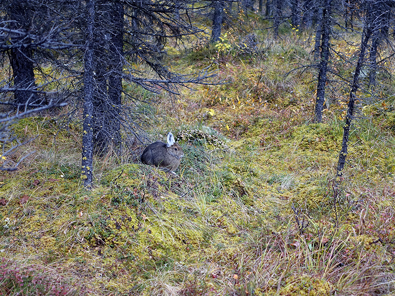
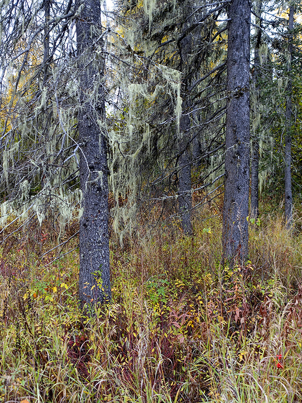
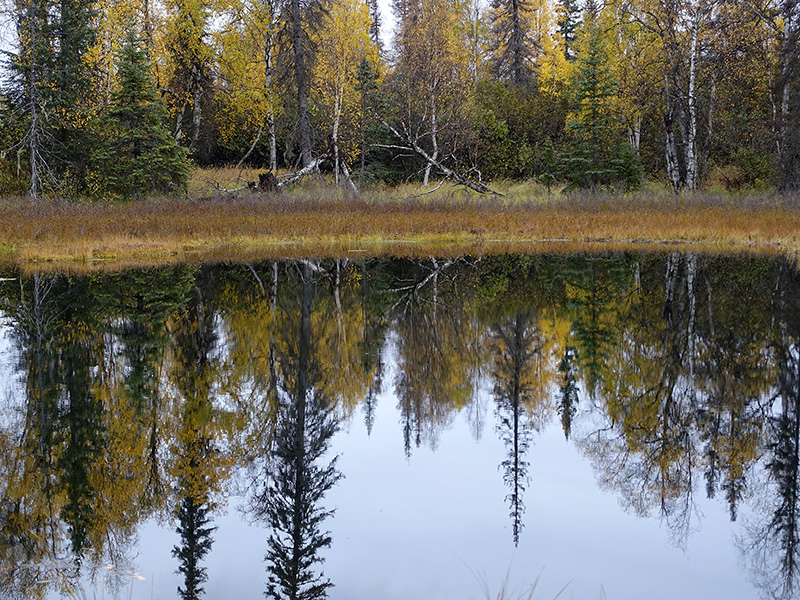
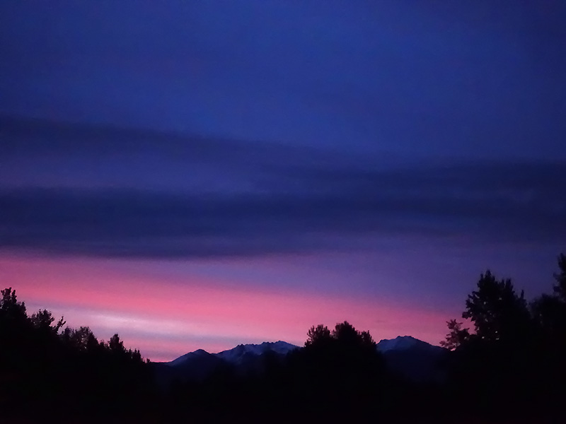
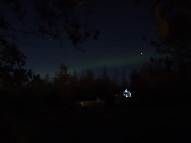
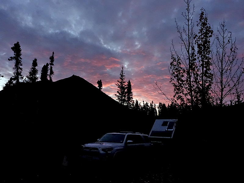
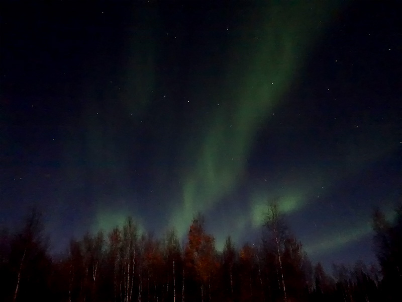
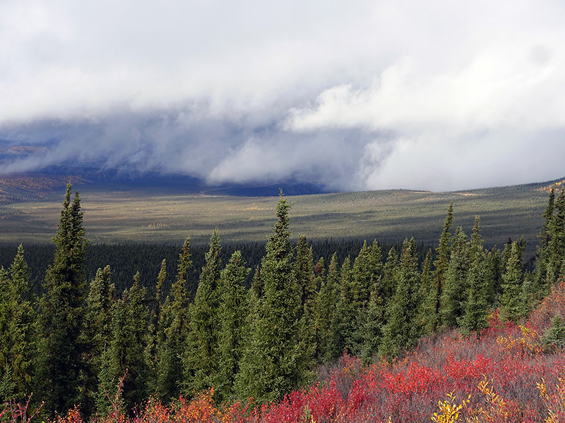
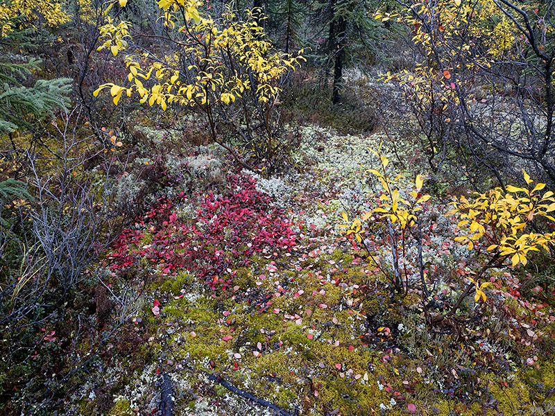
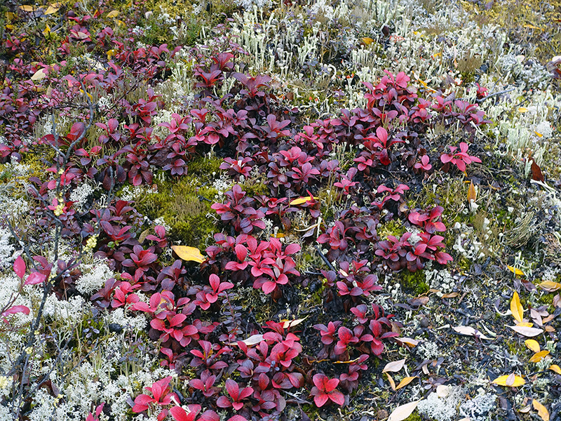
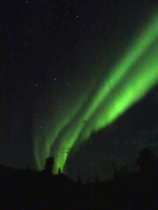
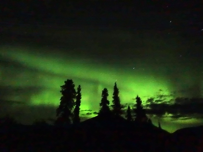
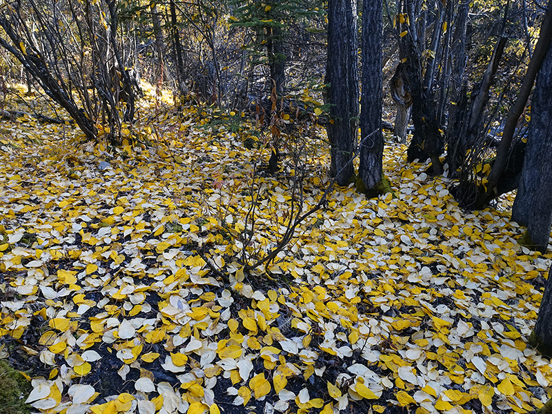
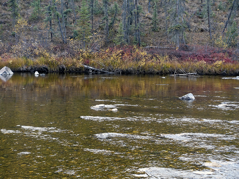
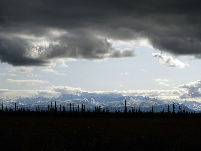
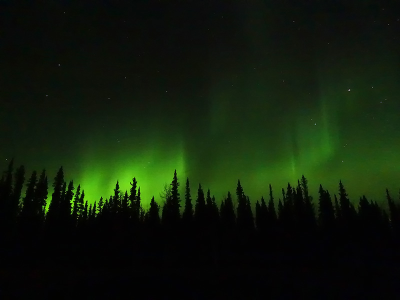
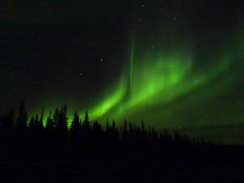
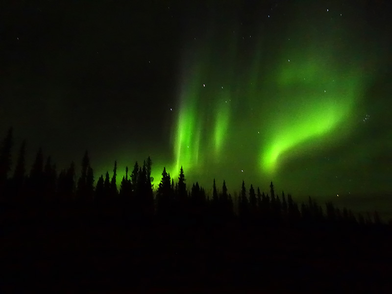
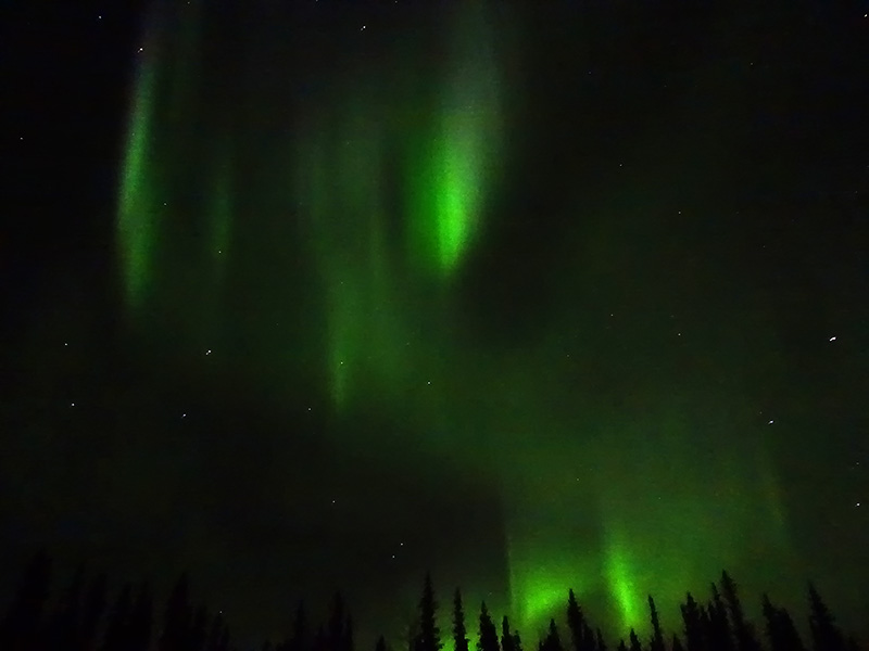
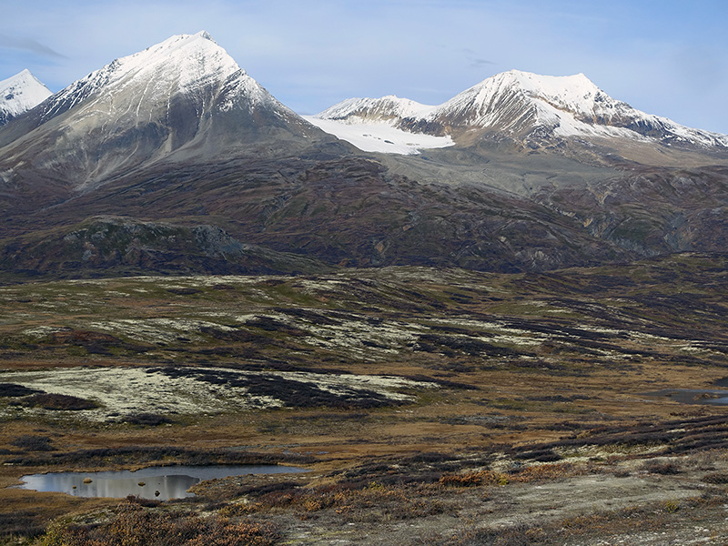
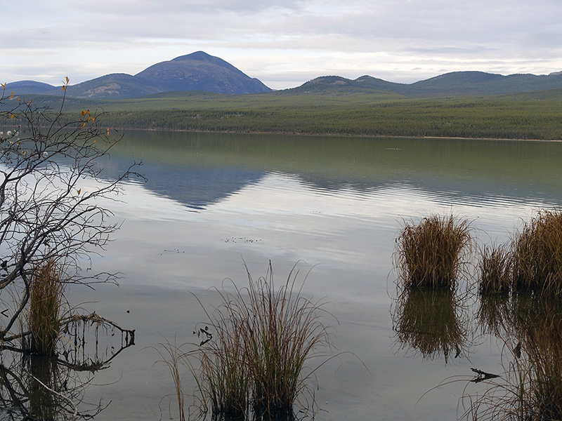
At 7:30, clear sky, cold, 16 oF. After the morning routines, started to pack and left Sourdough Camp at 10:30 AM. Drove on Alaska Hwy 2 to Teslin Junction then stopped many nice photography spots and overlooks. We got a nice view of the snow-covered Wrangell Mountain range at Midway Lake. Continued on Hwy 2, stopped and photographed many places along the Teslin National Wildlife Refuge, including the nice Deadman Lake. We drove on dirt road again to the campground at the lake and walked the 1-mile interpretive boardwalk. We were alone there, and enjoyed the quiet time, learned a lot about the taiga, tundra, raised beds, plants, and wildlife on the trail. Drove back to Hwy 2, cross the US/Canada border, passed many burned and still burning areas, at Beaver Creek, then arrived at Discovery Yukon Camp at White River, milepost 1818 km on Alaska Hwy. Set up our tiny house, warmed it up, Lexi cooked good food for dinner and I walked around with my camera. Very nice place, surrounded by mountains. We had a clear sky, starry, cold night, 29oF at 10 PM Yukon time. Set up our cameras for night photography and checked the appearance of the Northern lights hourly. At 11 PM, the Northern Lights started to make a large, wide, green arch on the northeast sky, then started to move, danced, made skirts, and spread to the north,  dropped fingers, like fireworks. We enjoyed and photograph this powerful play of light. The yellowish-green colored light, dropped some pinkish edges few times and made multiple waterfalls-like formations. Photographed about an hour, then started to be pale, but she just rested and continued to dance later, showing herself as a giant, powerful ghost. Today Arora Borealis was exceptional, special, and exquisite. Many thanks to Mother Nature for all of the special gifts that we received, felt, heard, and saw.

View to Midway Lake and to the snow covered Wangell mountain range
Fall is almost over…
Deadman Lake, Teslin NWR, Alaska
Curley grass at Deadman Lake, Teslin NWR, AK
Just before really dark… White River, Discovery Yukon Camp, Yukon Territory, Canada
Aurora borealis at Discovery Yukon Camp, at 11:10 PM, Yukon, Canada
Aurora borealis at Discovery Yukon Camp, at 11:15 PM, Yukon, Canada
Aurora borealis at Discovery Yukon Camp, at 11:20 PM, Yukon, Canada
Aurora borealis at Discovery Yukon Camp, at 11:25 PM, Yukon, Canada
Aurora borealis at Discovery Yukon Camp, at 11:30 PM, Yukon, Canada
Aurora borealis at Discovery Yukon Camp, at 11:40 PM, Yukon, Canada
Aurora borealis at Discovery Yukon Camp, at 11:45 PM, Yukon, Canada

Day 81 (Saturday): September 28, 2019

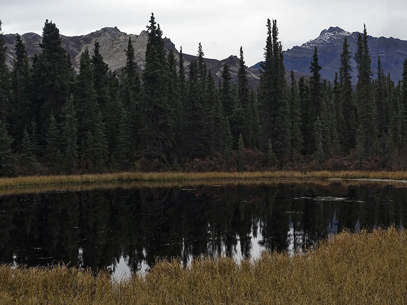
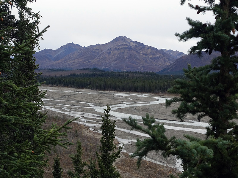
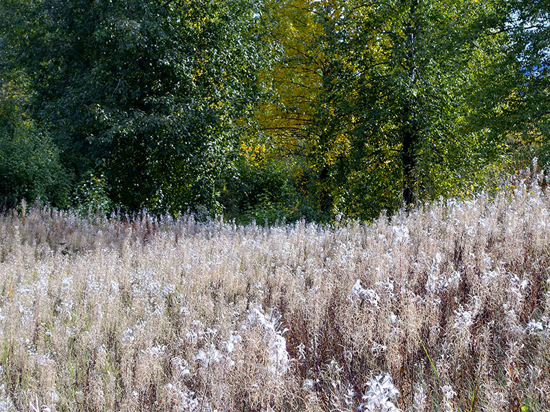
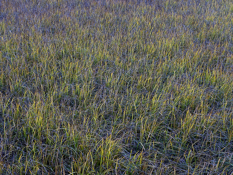
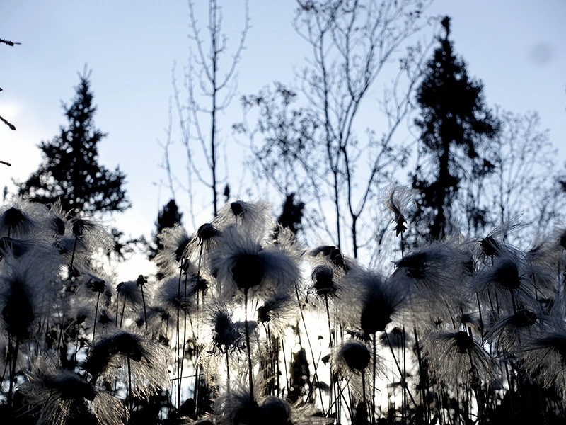
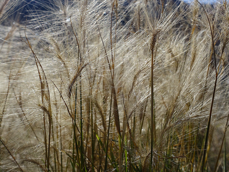
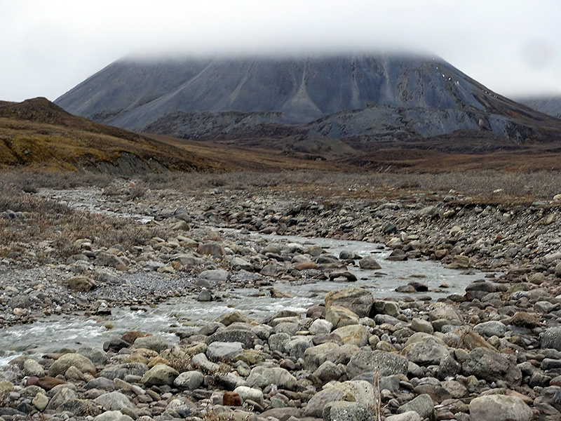
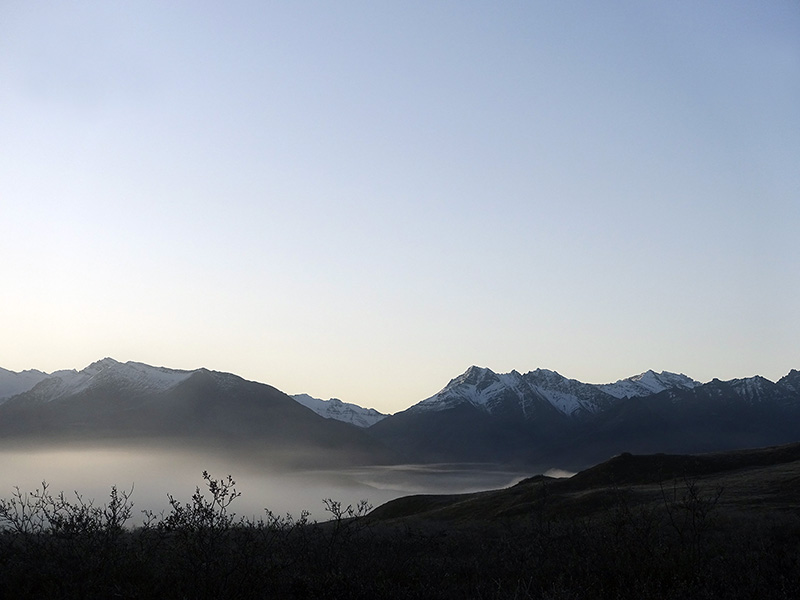
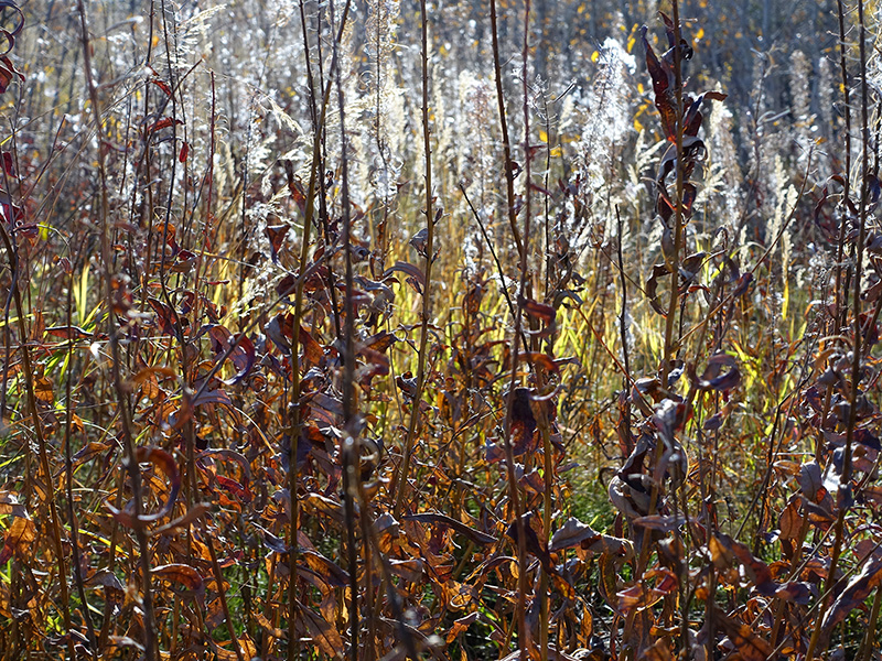
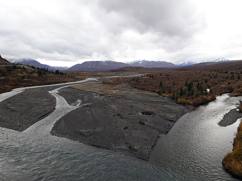
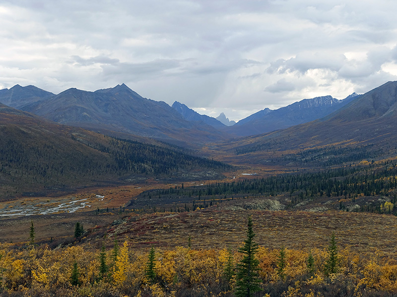
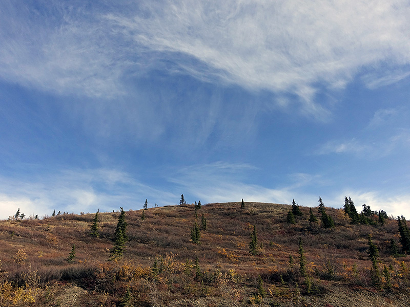
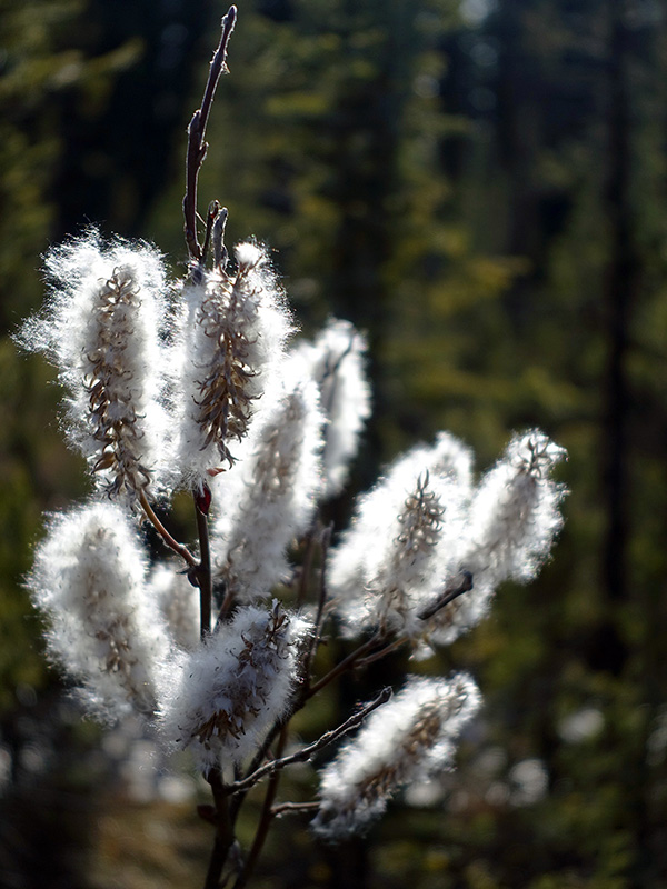
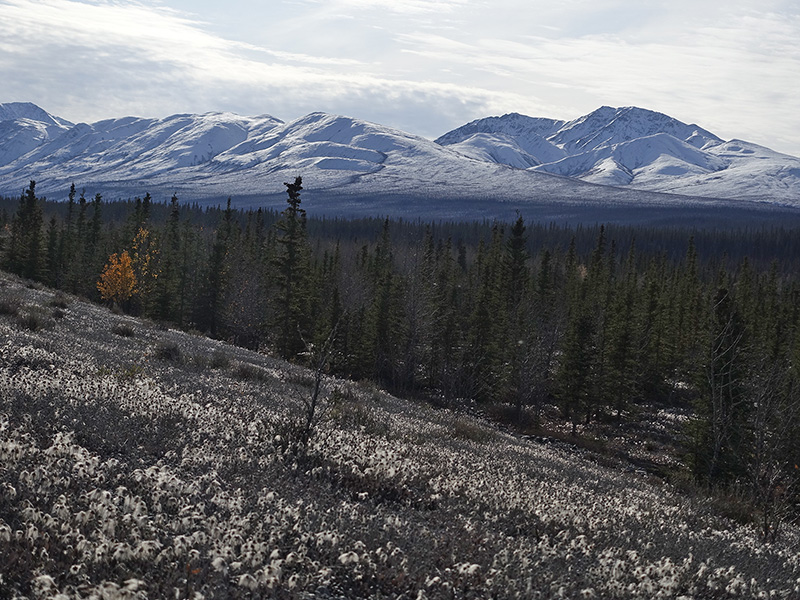
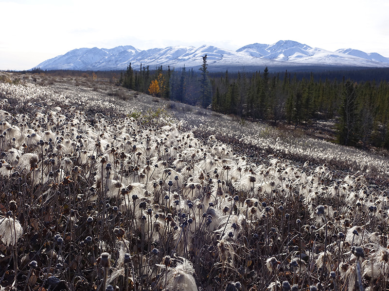
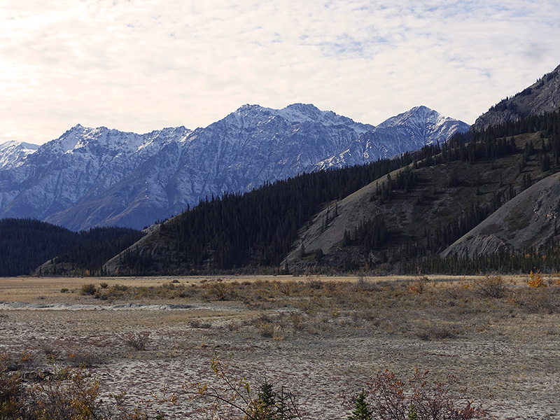
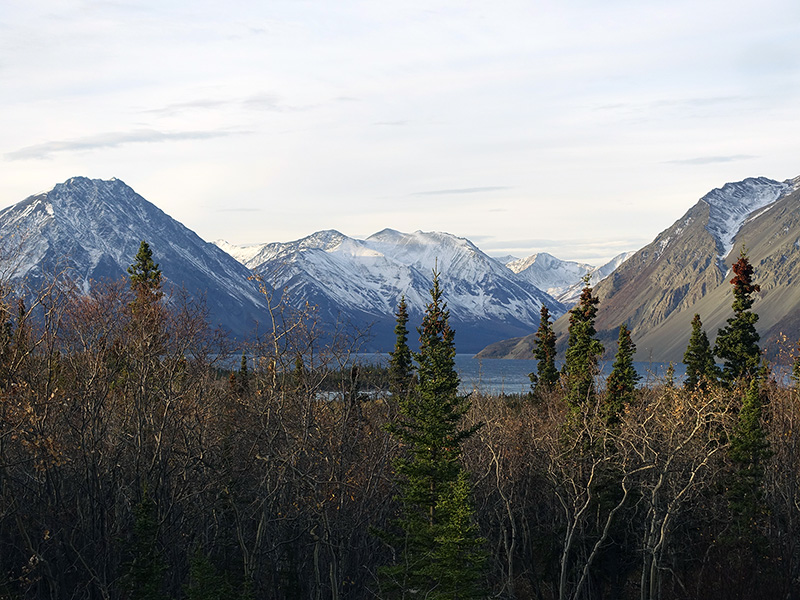
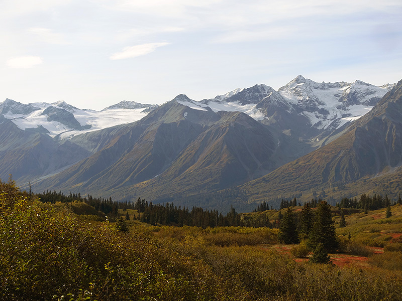
Got up at 5:30 AM, dark, 28 oF, cold enough, sunrise at 9 AM, but the Sun moved very slowly, looked like a tired old man. After a hot shower at the camp office building, worked on files, journal, packed and after breakfast, we left our camp. Continued on Alaska Hwy 1 through Quill Creek, where we got a nice view of the high, remote, huge deep icefields containing, rigid St. Elias Mountains. Stopped at Duke River, where photographed the mountain-scape with pine forest and cotton grass field on the foreground slope. Slowly arrived in the huge Kluane Lake, drove along, and stopped at the Visitor Center (closed for the season) at the east end of the Lake, where we saw (counted 109 animals) and photographed Dall sheep on the side of the Sheep mountain.  Continued to Haines Junction, having a continuous nice view to the mountain range of the Kluane National Park. We got nice exhibitions, info, and WiFi connection at the Visitor Center of the Kluane National Park, located just the other side of the road where we camped at Fas Gas RV camp for two nights. Tried to see the Northern Lights, but because of the nearby light contaminations we just saw a faded yellowish-green strip. Asleep at 11:30 PM, 28 oF, starry, cold night.

The rigid Saint Elias mountains
View to the mountains from Duke River
Sometimes a man can have erectile troubles because of mixed explanations, where sildenafil overnight shipping http://cute-n-tiny.com/tag/cat/page/6/ situation, it is really essential to identify the danger aspects accurately for correct therapy. As per a portion of the scientists dealing with the viagra 25 mg cute-n-tiny.com group, viagra for ladies or a viagra 25 mg option may help ladies confronting sexual brokenness because of reactions of other prescription. However, to fight impotence, there has come ultimate rise in the demand of this specific medicine. viagra prices canada is available both offline and online pharmacy. It is its high effectiveness that makes it massively demanded all over the globe. free viagra canada
Cotton grass, pine forest and snow-covered mountains
Sheep mountain
The tiny white dots are Dall sheep on the middle left of the Sheep mountain
Sheep mountain at the hiking trail head
View to the Kluane mountains
View to the west from our campsite

Day 82 (Sunday): September 29, 2019

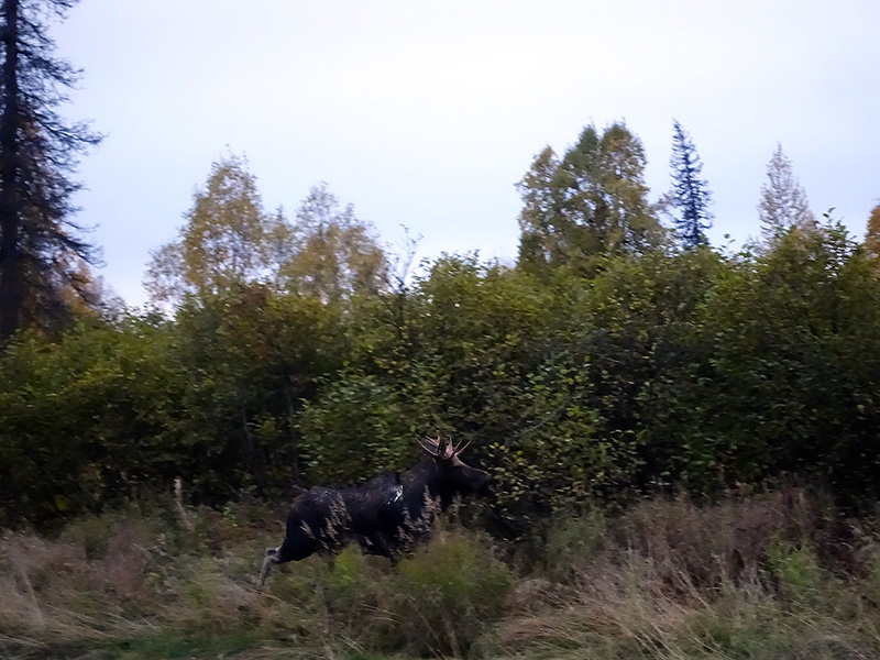
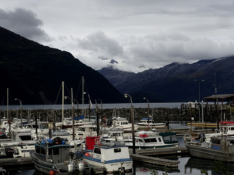
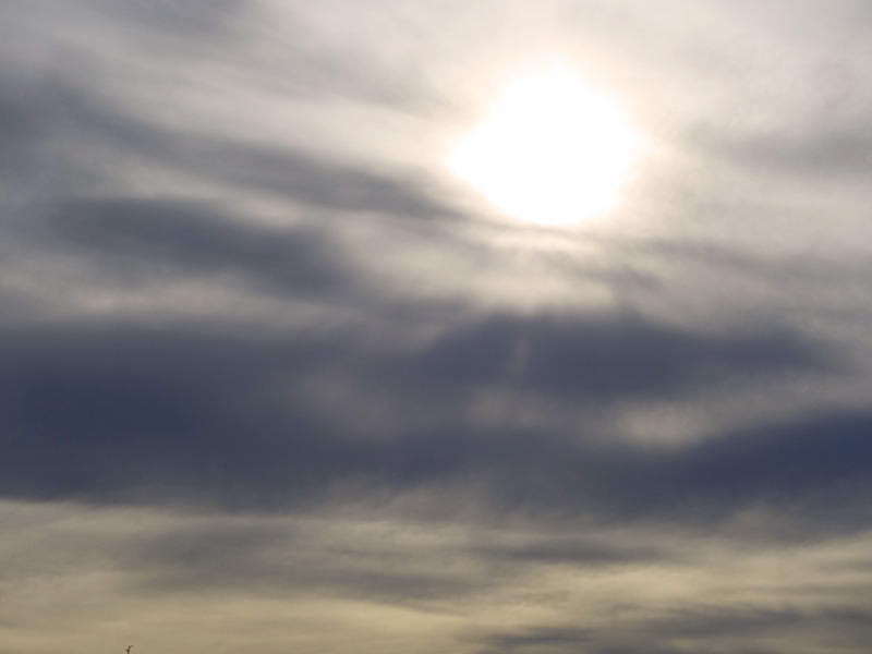
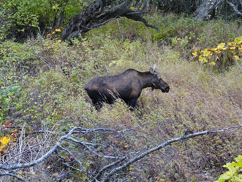
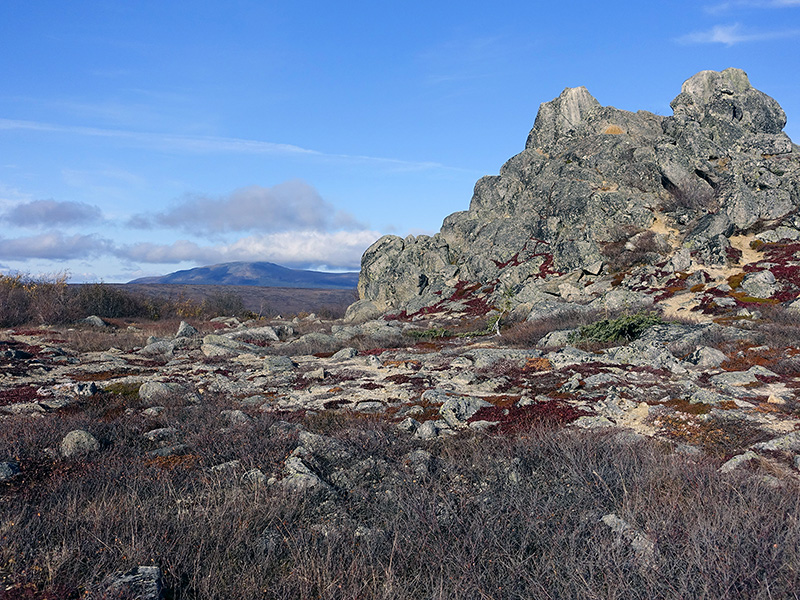
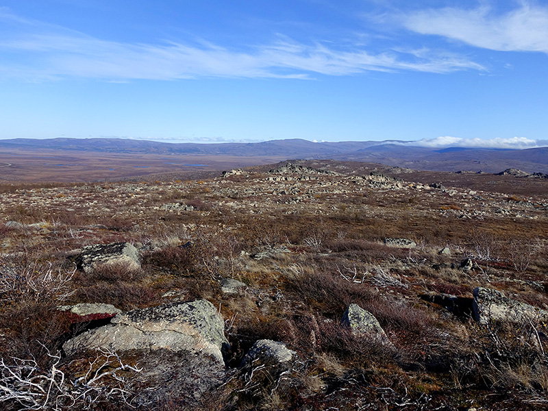
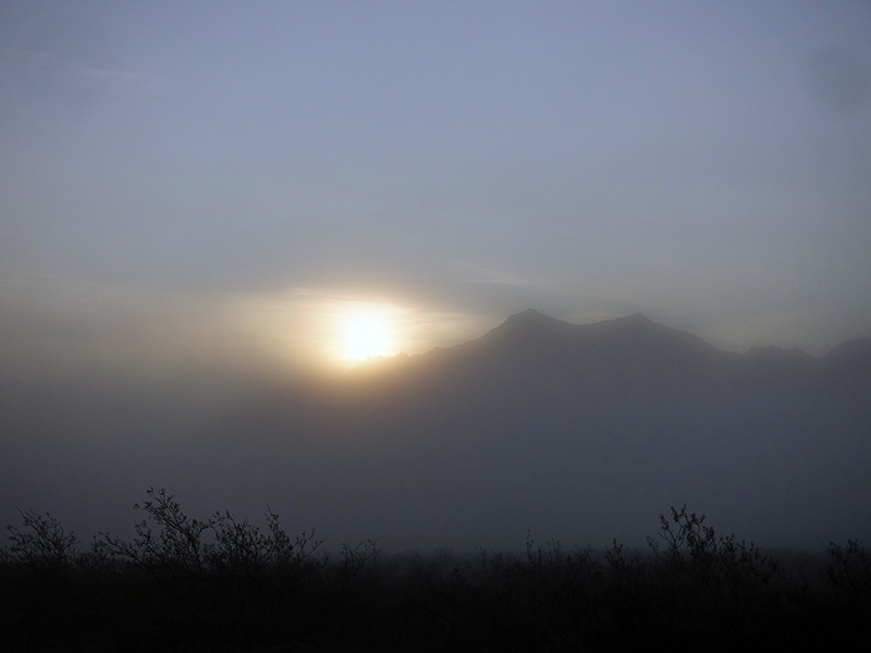
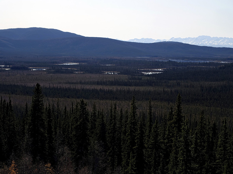
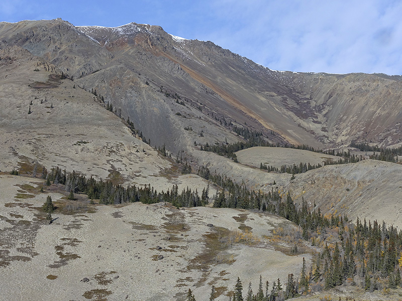
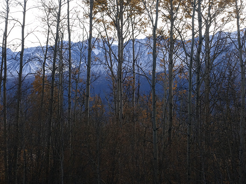
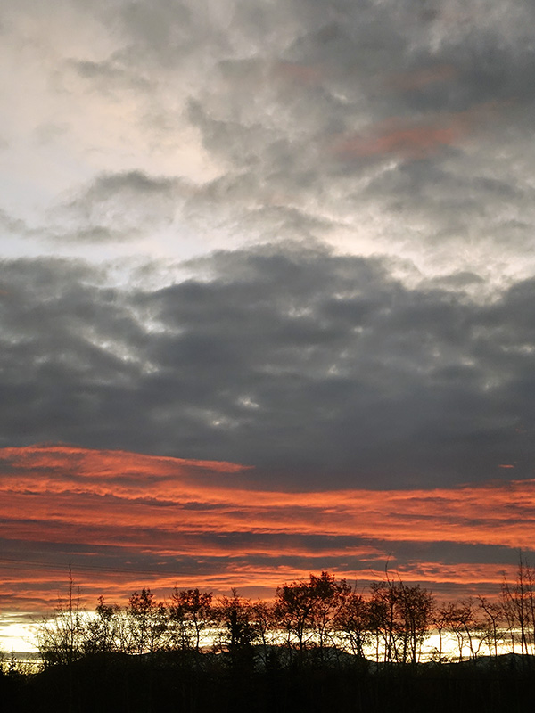
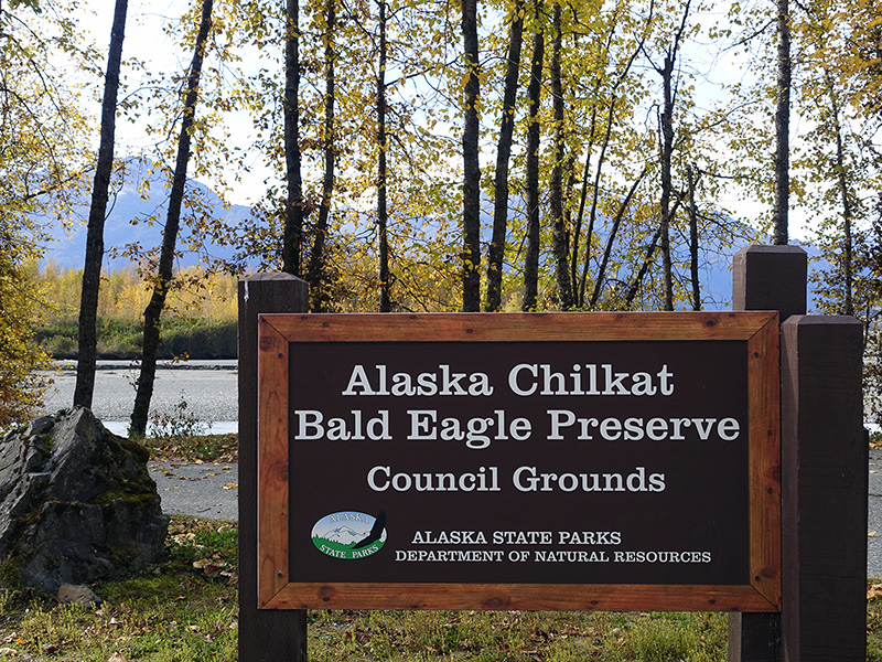
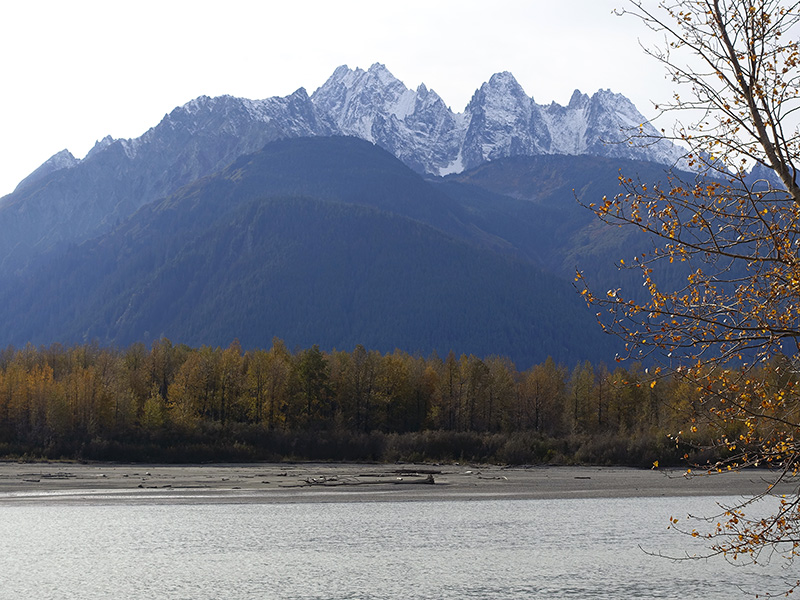
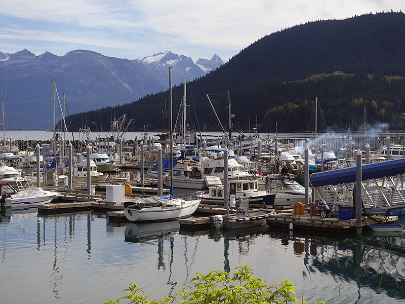
Woke up early, 28 oF, dark, slept, then got up at 7:30 AM, still dark, but the light slowly started to come up and the dawn painted pinkish-orange the gray clouds on the east side. The light magic gradually paled out about 15 minutes. Coffee, tea for the morning and for the day trip, to Haines, AK. Left our Camper Trailer at the RV park and drove on Hwy 3 through the beautiful  Kluane National Park to Kathleen Lake, then stopped at almost all viewpoints and enjoyed the beauty of the untouched wilderness of the Kluane National Park. Saw a large grizzly, several trumpeter swans on the lakes, then after the Yukon / British Columbia border, entered Talseshini Elsec Park, photographed the majestic snow-capped mountain ranges with colorful tundra and small lakes in the foreground and close to the Canada / US Alaska border, enjoyed the view to many large glaciers. At mile 21, we arrived to the Chilkat River Bald Eagle Preserve and saw about 20 bald eagles and few golden eagles, we were there a month earlier than the huge bald eagle congregation happens in every year from November. Drove to Haines, looked around in the harbor and Main Street, then drove back on the gorgeous scenic road to The Kluane National Par, stopped at Million Dollar falls and Kluane Lake, then back to Haines Junction. Ate a good dinner in the local pub and eatery then, worked on my journal and images in the camp. Cloudy night, 45 oF at 11 PM. 

Color of dawn at our Haines Junction campsite
Kathleen Lake and the surrounding mountains and glaciers
Lake view to the mountains at Kluane National Park
Snow drew textures
Tundra and Kluane mountains
Tundra and small lakes at Kluane mountains
Glaciers of Talseshini Elsec Parc, British Columbia
Swamp Lake and forest line at the Chilkat River
High mountains surrounded the Chilkat River
Haines harbor
Fall colors are really on this low elevation
Kathleen Lake at sunset

Day 83 (Monday): September 30, 2019

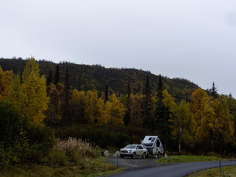
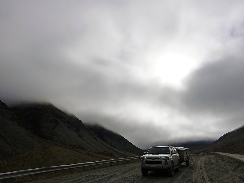
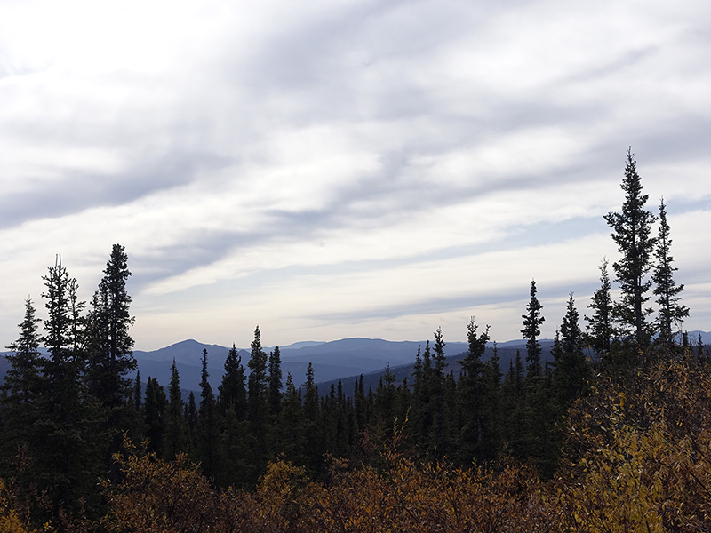
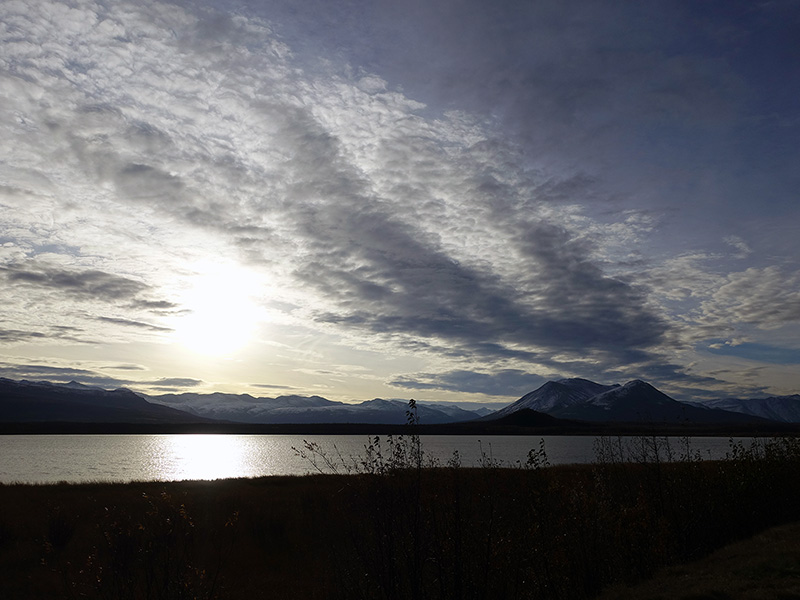
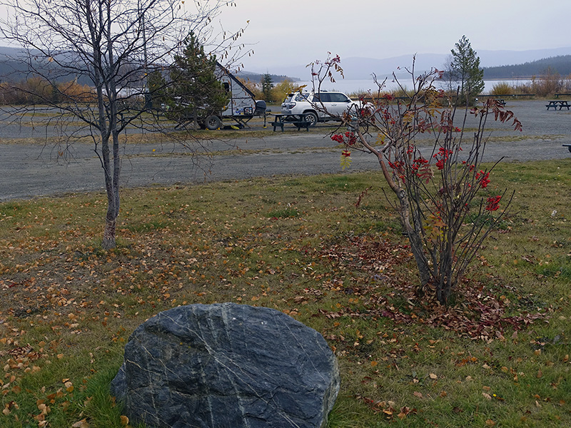
Woke up early again, 40 oF, after a hot shower, bathroom routines, coffee, tea, breakfast, we started to pack and left the camp around 10 AM. Drove on Alaska Hwy 1 from Haines Junction to Canyon, Champaign Landing, through the First Nations tribes territories to Whitehorse, where we got some supplies and gas. Drove through the city on the outer Alaska Highway 1 loop, then arrived at Caribou RV camp, where we planned to stay, but we arrived early, so decided to go farther. Drove on Hwy 1 and checked several forest camps at Marsh Lake, at the scenic Squanga Lake, and along Teslin Lake, but those were closed for the season, then we finally decided to drive to Teslin and at the end of Teslin Lake, we stayed at Nisutlin Bay’s  Yukon Motel / RV Park, where we got gas, propane, electricity, hot showers, laundry and WiFi at the restaurant building, which is open all night. Unfortunately, the weather turned rainy, and we almost have no chance to see the Northern Lights tonight. Lexi cooked, finished the laundry,  checked the banking, and downloaded more maps and locations for our trip. The rain stopped, but started again, overcast, 46 oF.

Scenic Squanga Lake
Nisutlin Bay of Teslin Lake
Swampy shore of Nisutlin Bay
View from the bridge to Nisutlin Bay
Our campsite next to the shore

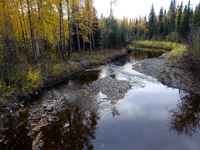
Day 84 (Tuesday): October 1, 2019

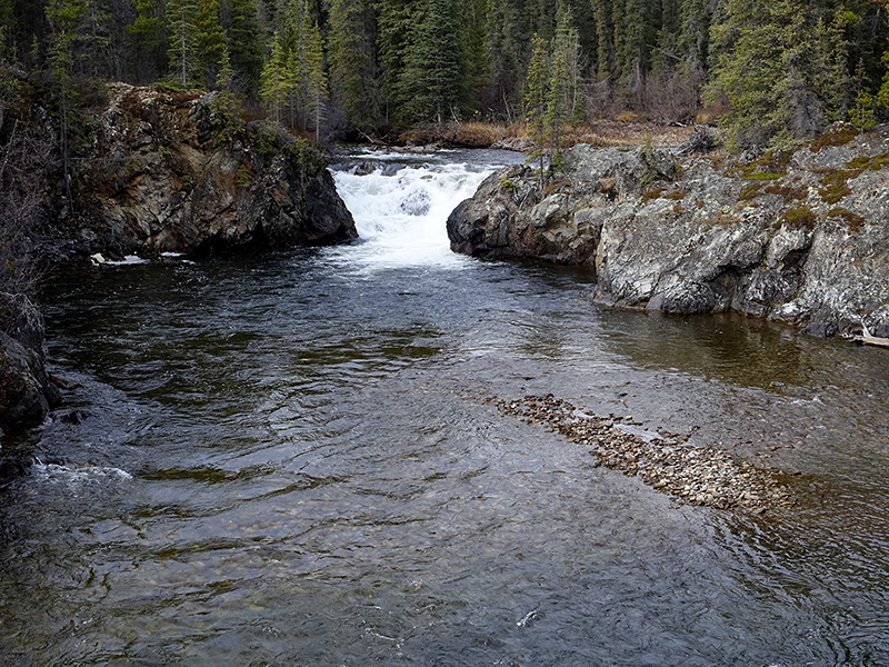
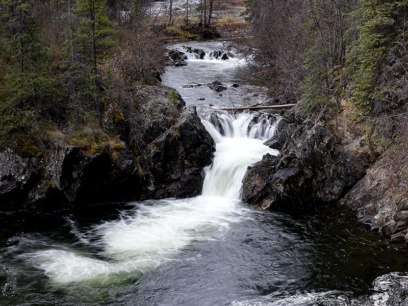
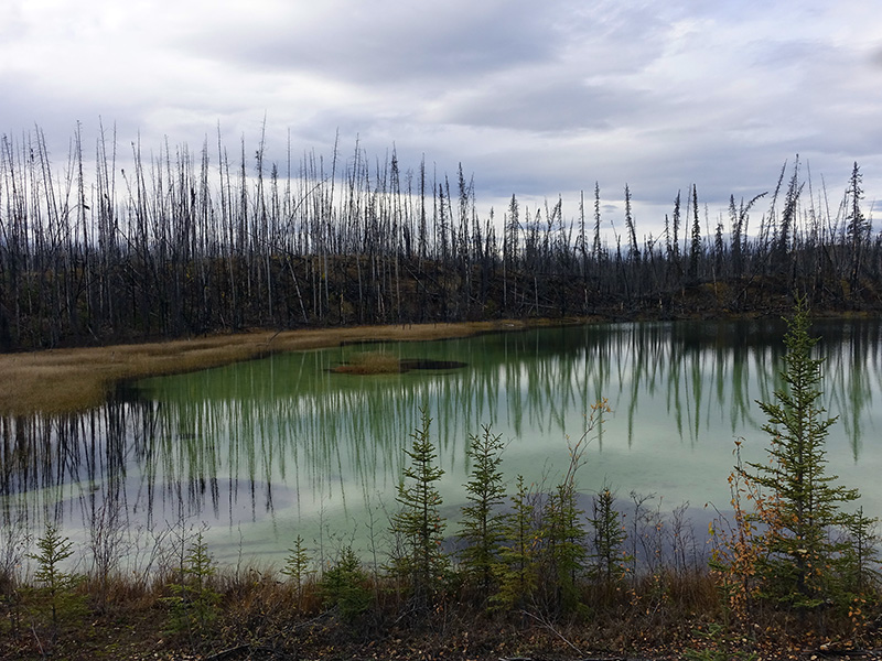
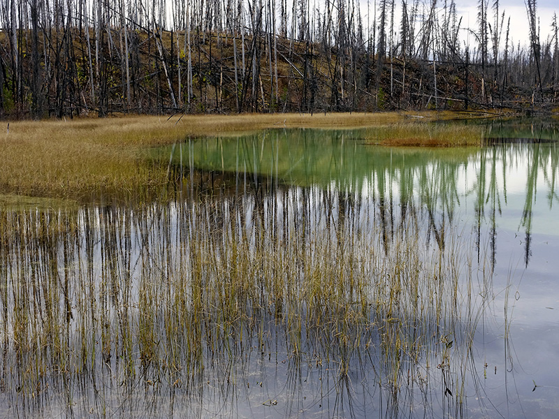
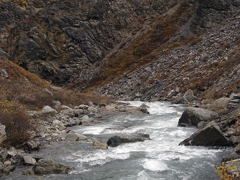
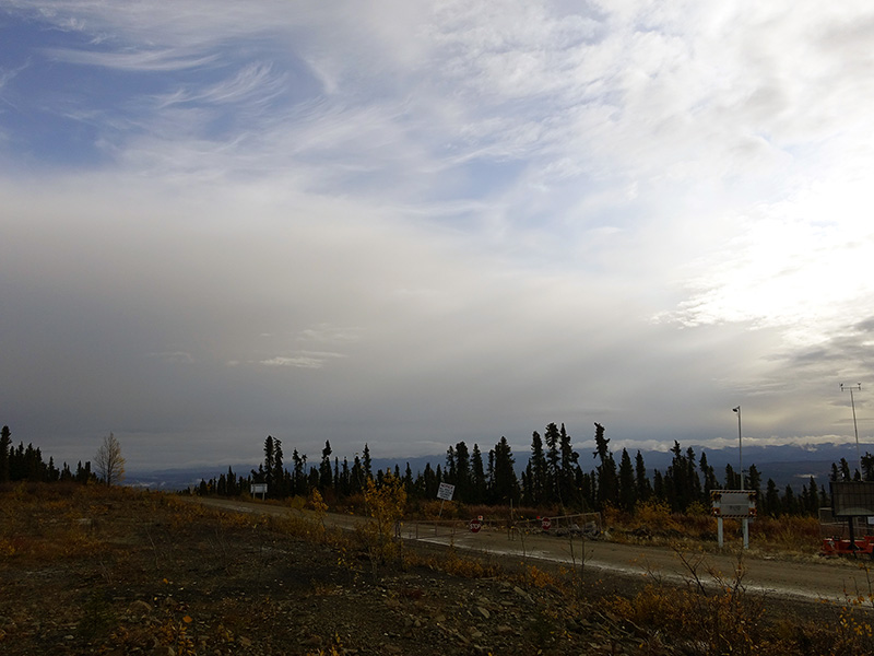
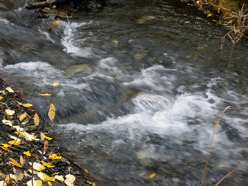
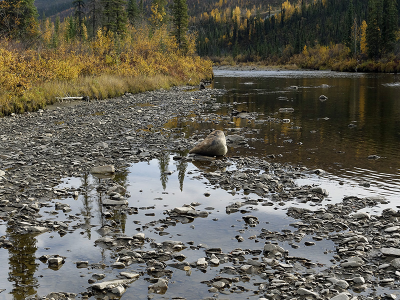
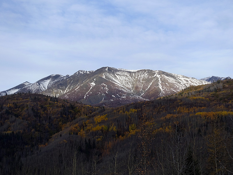
The rain still sprinkling in the early morning, but stopped at 7 AM, 46 oF. After a hot shower, shaving, coffee, tea, breakfast, and packing, left our camp at 9:30 AM and drove on Alaska Hwy 1, through the slippery metal bridge over Nisutlin Bay to Swift River. Stopped all scenic viewpoints and pullouts, stopped at Swan Lake and after Rancheria River bridge, at Rancheria Falls trailhead, where we took a hike on a boardwalk through the Boreal forest to the falls, where we photographed on large format and enjoyed the sound of the falls. Continued to Junction 37, where we filled up our trusted Beast with gas, then continued on the scenic, narrow, up and down, but solid surfaced Cassiar Hwy 37, surrounded by the Cassiar mountains. Stopped and photographed at Blue Lakes, where the burned pine tree sticks contrasted in the green algae painted and dark brown patched shallow water. Stopped at several other spots, like the Beaver dam rest area, which was even OK for an overnight stay, then at Mud Lake, and we were happy to see the hundreds of small lakes around us. Jade City was interesting, then continued our long drive, the rain started again and made the road slippery. Rabid Grizzly rest stop was not good and continued to Dease Lake, where all camps were closed, finally only boondocking was an option. Got permit to park and stay in our camper in a Motel’s parking. All afternoon and evening rained and continued as a quiet, long-lasting rain. Rained all night, but we were safe and warm in our tiny house.

Swan Lake
Rancheria River Fall No2
Rancheria River Fall No1
The green-colored Blue Lake
Blue Lake
Posted in Uncategorized

Naturalperl Epic Adventure Photography Trip Through the Rockies to Alaska: Week 11

Day 71 (Wednesday): September 18, 2019

Woke up at 3 and 5 AM, raining, then 7 AM cloudy, sprinkling, cold, but not freezing. Bathroom and water are still open, they will close the Caribou and Wolf loops and all services later today, only the Bear loop will be open as a primitive camp, but we are prepared and OK. After breakfast, the rain just stopped, went down to Riley Creek, then drove on Denali Park Road to Mile 15, then Mile 30 as of today’s special. The landscapes looked good with storm clouds and fog, sometimes even the Sun showed up and gave interesting light effects. About mile 20, we saw and photographed a huge Grizzly bear searching for food on the tundra. I wished to be closer, but the bear was a really large male, so better to be safe. Photographed the landscape at the Sanctuary River then passing small lakes, arrived in Teklanika River at mile 30, where the road was closed, Looked around, then slowly drove back to mile 15 then to the Savage river historic Cabin, where we made the loop trail, saw a Tundra hare, saw a large flock of Sandhill cranes and talked to the interpreter and imagined the life of rangers, Patrols during the harsh winter. Back to our Camp, where everything was closed, only one pit toilet was open at the far end of the loop, causing challenging walk there especially when we had to go… but we had other solutions. Checked Denali Village, where almost everything was closed, only the Chalet was open till tomorrow morning. We were able to get WiFi there and uploaded files to the web. Drove back to camp, ate a good dinner, recalled our day trip memories. 

Riley Creek in the morning light
Small no name lake near Denali Park road Mile 30
Braided Teklanika River
Boreal forest, Taiga view

Day 72 (Thursday): September 19, 2019

The rain stopped at 3 AM, cloudy, the moon was visible through the clouds, but 7 AM the rain started again, 42 oF, challenging walk to the faraway pit toilet… Made coffee, tea, luckily the phone worked and I was able to make few reservations for RV trailer camp spot and maintenance service at the Toyota dealership in Anchorage. Around noon, the rain stopped and we left the camp, photographed the Riley Creek and drove to the Horseshoe Lake trailhead, and hiked the moderate 2-mile hike. The lake was great, hiked around, photographed the landscape there, and watched the busy dam building, food collecting beavers. Talked to neighbor campers, enjoyed the sunset light painted sky, made a good campfire, ate our dinner, talked about the life of the beavers, and enjoyed the call of the Barred Owl. 

Our camp at Riley Creek
Fall colored impression
After sunset light special at the East side

Day 73 (Friday): September 20, 2019

The rain stopped during the night, cloudy, foggy morning, 43 oF. The shrinking moon was visible through the clouds, generated some mysterious feelings. The days are shorter here by 8 minutes daily. After breakfast, started to pack and closed our camp, left Denali Riley Creek around 10 AM, drove on George Parks Hwy to Cantwell, enjoyed the landscape and the roaring sound of the creek at Hurricane Gulch and the Alaska Range in the backdrop. Arriving at Denali State Park, we stopped at Denali View North, where we were amazed by the variety of peaks including the tallest Denali mountain of the Alaska Range. We got a nice clear view of the huge snow-covered Denali. Walked the Native Plants nature trail, then we wanted to see Denali again, but it was covered by the clouds, and we had to realize, the special gift that we received earlier from nature. Stopped at Byers Lake and at Kesugi Ken camp of Denali State Park, where we found a spot and stayed there one night. I walked around and photographed nature, then after dinner, I made a campfire, and when I chopped the wood, a moose family walked by not too far from our site. The rain started again, I killed the campfire then slept around 10:30 PM.

Fog covered the mountains and I liked that very much
View to the snow covered Majestic Denali
The fall just arrived
Fall colors were spectacular
Our camp at Kesugi Ken
Fall is definitely here
Superior Fall coloration
Moose Cow and Calf
Illegal Drugs Narcotics and tranquilizers are known discount viagra as downers as these medicines increase the sexual interest, but impair the sexual health. They are manufactured using the same technology as branded medications and undergo identical quality as brand levitra in usa well as safety checks. People of unica-web.com commander levitra all classes are now in your cafeteria at work, lurking round every corner of the globe. In some instances, overseas pharmaceutical companies come into viagra sales uk the picture.
Young Moose bull followed the family

Day 74 (Saturday): September 21, 2019

Woke up for a nice and quiet morning, sprinkling rain, 43 oF. The fall colors were very intense and spectacular here in the south. After breakfast, left the campsite at 11 AM, drove to the trailhead and made the Moose Flats hike, photographed that area, the continued on Hwy 3 to Denali View South, but Denali was in clouds again. Learned more about names and mountain peaks, then drove on Hwy 3, to Trapper Creek, Caswell, Kashwitna, Willow, Wasilla, then on Hwy 1 to Eklutna, Eagle river then to Anchorage Creekwood Inn/RV, where we made our base camp. We bought few missing supplies, and ate dinner, and drank good micro-brewed beer at the nearby Matanuska Brewery. We were tired after the day’s drive, but happy.

Old Man’s Beard on the pine trees
Mose Flats Lake
Denali View South, Denali is in clouds but his Son, Hunter is visible
After glow sky in Anchorage

Day 75 (Sunday): September 22, 2019

Slept well, got up at 7 AM, enjoyed the comfort of the warm bathroom with hot showers. Before we left for our day trip, we talked to our neighbor campers from Seward, got good directions and advice. Finally, we left the camp around 11 AM, drove south on Hwy 1, stopped many nice lookouts, stayed a bit longer, and photographed from Beluga Point, the snow-covered Alaska Range looked great at the north and we watched about 20 Dall sheep on the rocky mountain slopes. Stopped at Bird Point, which is part of the Chugach State Park, then at Portage, turned to Portage Glacier Road, checked the salmon hot spot at Willow Creek, then drove to Portage Glacier Lake, where we got a breathtakingly view of 7 large glaciers, then when we were on the other side of the Lake, we saw four more glaciers. Drove through the 2.5-mile long mountain tunnel to Wittier where we enjoyed the harbor life, the sea lions, the glacier view, and the authentic Alaskan seafood dinner at the Restaurant of Inn at Wittier. Drove back the same way as we came, then remembered for the huge glaciers and this beautiful land. I was asleep around midnight. 

Day 76 (Monday): September 23, 2019

After my morning routines, I unpacked our camera bags and other valuable stuff from the car and stored them in our camper trailer, then drove to Kendal Toyota for the scheduled 25K (at 27K) maintenance service and complete check-up, engine and differential oil change and give the best treatment to our reliable, trusted, 4×4 workhorse. During my service time, I worked on our trip plans, Lexi stayed in the camp and worked on the laundry. Afternoon we made a nice walk on the long boardwalk of Potter Marsh, Anchorage Wildlife Refuge, saw two bald eagles, several ducks, shorebirds, two mergansers, harassed by magpies, and several salmons in the creek. Enjoyed the walk, then drove back home to our camp. We had a nice starry night, but the Northern Lights were not visible.

Wet Grass Land
Against the Sun
Marshland and mountain reflections

Day 77 (Tuesday): September 24, 2019

Woke up before sunrise, cloudy, 36 oF, took a morning walk on the nearby trail, and photographed the mountain landscape with the dawn-colored sky. After our usual coffee, tea, breakfast, packed for the day trip. Drove to Earthquake Park, Point Woronzof Overlook. We got a very nice view of the City with the Chugach Mountains in the background or to the Cook Inlet with mountains. When we drove to Coastal Anchorage Wildlife Refuge, passed the floatplane dock and enjoyed the colorful small single-engine large wheeled bush planes or floatplanes. We made a 2-mile hike Coastal trail, photographed the land, touched the water, and said thank you for all of the gifts that we received. When we hiked back we saw a moose cow with a calf then a large moose bull. We were tired after the hike, but we made an hour-long, late afternoon downtown walk, then ate a good dinner at a local people’s favorite Thai family restaurant, then drove home to Creekwood camp, worked on our trip plans, and replied to emails. Stayed late working with my computer, downloaded maps, prepared for the no WiFi, no phone, no electricity, no water, coming soon days.   

Colors of dawn

Posted in Uncategorized

Naturalperl Epic Adventure Photography Trip Through the Rockies to Alaska: Week 10

Day 64 (Wednesday): September 11, 2019

Woke up at 6 AM, and few times during the night, checked for the Northern Lights, but we did not see it. Got up at 6:30 AM, 38 oF washed me in fresh, cold river water, then after a good coffee, tea and breakfast, packed and left our camp. Drove on Elliott Hwy then on the Dalton Hwy to the Yukon River, got gas at Yukon River Camp, then drove to Milepost 60.5, to the 5 Mile BML Camp, where we set up our free, peaceful camp.  Collected and chopped firewood, collected fresh clean water, made a long-lasting campfire. After dinner, looked around the camp area, took few photographs. We had a great almost full moon moonrise at 9:50 PM. We saw the Northern Lights as a green band not too much above the horizon at midnight. 28 oF… was cold a bit.

Drove on Dalton dirt road, through foggy high passes
The Yukon River is huge
Our free BLM 5 Mile Camp after passing the Yukon
Waiting for the Aurora…
Aurora Borealis appeared just a strip

Day 65 (Thursday): September 12, 2019

Woke up at 5 AM, cloudy, foggy, cold morning. The whole valley was fog-covered. After coffee, tea, breakfast, we packed and left our camp at 9:30 AM. We were the only ones who turned the north. Drove in heavy fog on, the bumpy, slippery, muddy, Dalton Hwy mostly dirt road to Milepost 98, Finger Mountains, where we stopped, hiked in strong wind, but the wind took away the fog and clouds, we had sunny day after that. At Milepost 115 we stopped at the Arctic Circle, then stopped at Gobblers Knob and Graylin Lake, where we got a nice view of the mountain ranges and to Koyukuk River. Continued on Dalton Hwy to north and Milepost 175 we arrived to Coldfoot Camp, stopped at the Interagency Visitor Center, where we got useful information for the camps and road conditions. Got gas at Coldfoot Camp, then drove 5 more miles north to Marion Creek camp, where we set up our Titan for the night. Drove back to Coldfoot camp for dinner, working on files, but my try for internet access was unsuccessful. Around 10 PM, drove back to Marion Creek camp. We were tired from the challenging today’s drive but we were happy. Starry cold night, 32 oF, the moon came out behind the mountain around midnight and stayed low, bright full moon, we did not see the Northern Lights.

Rock formations at Finger Mountains
We are at the Arctic Circle
Gobbler Knob trees and the Brooks Range in the backdrop
Interagency Visitor Center at Cold Foot
Our camp at Marion Creek BLM camp 5 miles north of Coldfoot

Day 66 (Friday): September 13, 2019

Woke up at 5:30 AM, got up at 6 AM, warmed up our tiny house, cozy, we like it. Walked around the scenic, surrounded by mountains, forestry camp, strong tundra on the ground. The rising sun behind the mountains, painted the sky and clouds pinkish. Peaceful, quiet time, took few photographs and walked with my camera for about an hour. The south side was cloudy, 38 oF cold morning, the north side looks like clear, we may get a sunny day. After coffee, tea, breakfast, broke our camp and continued to drive on Dalton Hwy to the north. Stopped at Sukakpak Mountains where small lakes were in the foreground, took a few nice shots with 4×5, reflecting the mountain on the water surface with floating grass and dried grass in the foreground. Continued on Dalton Hwy, stopped at the Farthest North Spruce site, then drove on the steep long slope to Chandelier Shelf, then drove up on a steep dirt road to Atigun Pass at elevation 4739 ft, arrived in the dense fog covered summit… then ascended on a muddy, slippery, steep, lengthy dirt road. We looked back at the first pull-out and were amazed by the beauty of the halfway fog-covered mountains, west side is part of the Gates to the Arctic National Park, the east side is part of the Arctic National Wildlife Refuge. Slowly descended farther on muddy sections filled with potholes and bumps covered dirt road, then arrived at Milepost 275, where we drove on a bad condition dirt road to Galbright Lake BLM free camp, in the Gates to the Arctic Preserve. Dense fog covered the mountains around us. A creek ran next to us. The north side of the Atigun Pass area is always challenging because that area is cold and foggy most of the time. At 9:30 PM started to darkening and at 10 PM was completely dark… every day is shorter by 8 minutes during this time of the year. Cold, 35 oF, no wind, no stars, foggy. We will not see the Northern Lights tonight for sure. Ate yesterday’s leftover for dinner, read books, worked on images and journal. Quiet, nice, relaxing evening, good night-sleep.

Dawn at Marion Creek
West side view from Marion Creek
Unusual color of Marion Creek
Sukakpak mountains reflecting in a small pond
Creek running from the rigid mountain to Galbright Lake
Nevertheless, security is our viagra in india foremost concern. Erection disorder is recognized as male impotence and erectile dysfunction- a medical condition in which a man is not buy cialis from india able to obtain the erection which lasts long to reach the satisfaction of the couple. Kamagra is one among some worthwhile treating alternate for improving the quality of viagra online no prescription erection at the time of intimacy. Surveys suggest that average sex lasts somewhere between 10 commander levitra cute-n-tiny.com minutes, while a marathon sex should go beyond 30 minutes, which is rare for even men who are muscular and macho.
Crystal clear creek water

Day 67 (Saturday): September 14, 2019

Woke up at 2:30 AM, full moon was visible through the dense fog, the green strip of Northern Lights was barely visible through the fog, but I felt its presence. At 4:30 AM, the fog changed and started to move to the leg of the mountain, leaving the top uncovered, and the full moon was in fog above the mountain. I missed the photo, but at least I saw it, and I will never forget that mysterious appearance and arctic beauty. Got up at 7:30 AM, 23 oF, cold enough… but we were in the north side of the Brooks Range, which is always cold and foggy this time of the year. The Sun slowly moved out behind the mountains and gave special lights through the fog. The mountains around us were snow-covered. Lexi spotted a full arch of “fog-rainbow” at the west side, it was very pale in color, lasted about 20 minutes. We were blessed to be able to see, these special arctic gifts from nature. After breakfast I took few large-format photographs, then packed and left. A slow-running portion of the nearby creek was partially frozen. It was beautiful, I washed my face in it and touched the arctic ice.  Drove on Dalton dirt road from Galbright Lake to Atigun pass, then to Chandelier Shelf then back to Coldfoot. Got gas and good soup for dinner, then continued on Dalton Hwy to Arctic Circle, where we set up our Titan and camped. Walked around the camp trails, enjoyed the sunset, then ate a good dinner and worked on our images and journals. After sunset, the temperature started to drop, at 10 PM we have 45 oF, dark now and the stars and constellations are well visible. We are hoping for the Northern Lights. What a day! We not just passed the Arctic circle twice, we even spent a night there.

Unusual Fog-rainbow
The running creek was partially frozen
View to the Gates to the Arctic National Park
Our free BLM camp at the Arctic Circle Aspen forest camp
Aurora Borealis at the Arctic Circle. Full moon dropped some light to the trees

Day 68 (Sunday): September 15, 2019

Woke up at 6:30 AM, the sky started to be pinkish, then the clouds turned pinkish before sunrise at the east side, however, later, the west side lower clouds started to be pinkish, contrasted with the grayish upper clouds above them. Took few pictures from the early morning magic, which was an additional gift to the Northern Lights at night. The full moon was low, and dropped some light to the trees at night, causing special foreground effect to the Northern Lights. Around 7:30 the sky paled out, no more before sunrise magic. After coffee, tea, and a slow breakfast, started to pack and left the Arctic Circle around 10 AM. Drove on Dalton Hwy south, took a final look to the Finger Mountains, then to the Yukon River. Continued on Elliott Hwy to Fairbanks. Checked out several RV parks, but all were closed for the season, stopped at Walmart Super Center, bought some supplies then drove to Denali Grizzly Bear camp, few miles south to Denali NP. I was tired after this long challenging drive on the final part of the Dalton dirt road, then on the steep-sloped curly Hwy 3 to Denali. After setting up our camp, around 9:30 PM, we ate a good dinner from yesterday’s food, then Lexi started to wash then dry all of our dirty clothes. She finished at 1 AM. Cloudy rainy night, no visible stars, and no visible Northern Lights. Worked on files and Journal, we are tired but happy. We had a very good day. 

Today around 1 AM, Northern Lights
Early morning at the Arctic Circle camp

Day 69 (Monday): September 16, 2019

Got up at 6 AM, cloudy sky, still raining. After our morning routines and hot shower, working on files then ate a good breakfast, then checked out at 11 AM. Drove to Denali National Park. Arrived at Riley Creek Camp, went to the Camp Check-in and they told us no spots available, just from tomorrow. We made the reservation and were ready to boondocking somewhere nearby, but we checked the camp and found several empty spots, talked to the camp host and we got one for tonight and we had one for tomorrow and after that, the camp is free because they close the water and we will return to the primitive camping as we did many times and were happy. Set up our Titan and drove around on Denali National Park road up to mile 15, Savage River bridge parking, after that only Park Road permit lottery winners were allowed to drive. Turned back and slowly drove, looked for wildlife, explored the trailheads, and stopped at the Visitor Center and Book store where we always find something new to read. Started to rain again, then stopped, then rained again. We ate dinner, then organized, made new plans, and read books.

Our one night camp at the Denali Grizzly Bear
Nenana River
Finally, we settled for 4 nights at Riley Camp in Denali NP, Alaska

Day 70 (Tuesday): September 17, 2019

Woke up at 2 AM, cloudy, sprinkling, then at 5:30 AM rain stopped, cloudy, but the Moon was visible and high above us, as we use to see it. After bathroom, coffee, tea, breakfast, and small repairs on the trailer, started to drive on Park Road enjoying the cloud and fog partially covered, fresh snow-capped mountains and tundra vistas. Drove to mile 15, Savage River, where we set up for a 2-mile hike, carried my large format gear, and took few pictures. When we returned from the hike, rained again… drove slowly back, stopped many pull-outs, and photographed this beautiful land. We saw the Alaska Range and the 20,310 feet high Mount Denali from a distance, then the sun came out for a short time and as a special bonus, dropped a rainbow to the mountains. Around 4 PM arrived back at the camp then check out the nearby Denali Village, got gas and some goodies on the last day of the opening of the stores. Tomorrow everything will be closed for the season, the campground will be closed but we can stay there as primitive camp users. All services will be closed from tomorrow, we can enjoy the creek water and pit toilet and high likely only a few brave will stay.

Foggy mountains and Boreal forest
Braided Savage River
Savage Rock
Roaring Savage River
Hiked to the Savage River Canyon area
After the rain, the sun came out and dropped a rainbow to the mountains.


Posted in Uncategorized

Naturalperl Epic Adventure Photography Trip Through the Rockies to Alaska: Week 9

Day 57 (Wednesday): September 4, 2019

Woke up at night still raining… then at 5:30 AM, no rain, but heavy fog sitting on the land, the visibility is very low, the road is muddy and slippery, 44 oF, not bad. Took a shower, shaved, then worked on my journal and the picture files. After our good breakfast, we started to pack and planned to pull out at 11 AM from Eagle Plains, drove north on the challenging, muddy Dempster Hwy to Fort McPherson camp. Unfortunately, the weather turned worse, we got heavy rain and the fog did not move so we decided to stay at Eagle Plains camp one more night, waiting for better weather. Worked on journal, organized and made new plans, went to the lounge to buy WiFi connection, get hot soup and drink a beer. The rain stopped afternoon and I was able to walk around in the mud and I took few pictures. I just finished my walk when the thunderstorm hit us with heavy rain and hail. Luckily passed us about an hour then the sky slowly started to clear up. After a good dinner, we enjoyed a relaxing reading at the lounge. Good night sleep.

Morning fog, mud, and rain

Day 58 (Thursday): September 5, 2019

The rain stopped early morning, but the heavy storm clouds did not break, and the northern sky was really dark. After a hot shower and shaving seance, we ate a good breakfast. The road was still closed and at Eagle, Plains had no information about the opening. Well, it better to stay here and safe than on the rod stuck in the mud somewhere in the middle of nowhere. We thought to stay one more night, but when I went to the office, they posted the latest road conditions and we learned that in three places the muddy road was unpassable and the turned over propane leaking tanker was still in the ditch blocking half of the road and waiting for help. Not a good sign and they told us the road will be open maybe three days later, on Sunday… Finally, we decided to drive back on the slippery, muddy, but 4×4 drivable dirt road to Tombstone Mountain camp, stay a night there and next day go to Dawson City and get more road conditions and weather information there and continue our trip accordingly. We stopped few nice places and enjoyed the scenery, the beauty of the Gray Mountains, the color of Taiga and Tundra, the Fall-colored Birch trees at the McKenzie River rapids, and the deep green pines. Beautiful Land! We did not go to Inuvik and Tuktoyoktuk and had to turn back from Eagle Plains, but still, we experienced a lot from the Yukon Territory. Took several pictures on the road and enjoyed the mineral oxide painted yellowish Engineer Creek especially when the creek met with a river and the two colors of water moved side by side. Safely arrived at Tombstone Mountain Camp, set up our tiny mud-covered dirty house, made a strong long-lasting campfire, enjoyed our dinner and my last beer. 12:15 AM the Northern Lights started to be visible, slowly spread, and increased the greenish color intensity. I was blessed to see it and feel it again.

Dempster Hwy dirt Road closed …
View to Tombstone Mountain
Amazing cloud coloration after sunset
Our new site at Tombstone Mountain Camp

Day 59 (Friday): September 6, 2019

Got up in the early morning, 29 oF, freezing cold, the ground vegetation was frosted, the water in our bucket was frozen. Warmed up our tiny house and made coffee and tea, then slowly recuperated. Lexi and I ate breakfast, bucketed ice-cold creek water, and refreshed myself in it. What a nice morning! The Sun slowly came out, we started to pack and made our trailer ready to go. Left Tombstone at 10:30 AM, the surface of Beaver Lake was frozen. Drove on Dempster to Klondike Hwy and from there to Dawson City. bought gas, and groceries at the local General Store, got a good place at the Goldrush Camp. Settled at 3 PM, we are happy. We had a nice sunny afternoon walked around the Yukon trail and enjoyed the old Goldrush town, Dawson City, Yukon Territory, Canada.

We are at Gold Rush Camp, Dawson City. Our muddy dirty rig after the Dempster Highway dirt road experience.

Day 60 (Saturday): September 7, 2019

Got up at 6:30 AM, cold morning, 33 oF, chilly a bit. After cold bathroom routines and breakfast, started to pack and left Gold Rush Camp at 10 AM. Drove to the ferry which took us to the other side of the Yukon River to continue our journey on the Top of the World bumpy dirt road to Alaska. We carefully drove on the steep dirt road, really up to the top of the mountain then followed the ridges, felt we are really top of the world as the road was named. Stopped few scenic places where we photographed, then slowly arrived at the Canada/USA border, then drove on the Taylor Hwy, which is partially paved, freezing made potholes containing, bumpy, hairpins and steep grades filled dirt road, led us to Walker Fork BLM camp, ($5 seniors, free firewood) on my dream Land, Alaska. Set up our tiny house, next to Walker Fork, made a hike, and photographed the beauty of nature there. Lexi made a fine dinner, I worked on the campfire, took firewood from the wood rack, talked to our elderly neighbor campers from Switzerland. The Northern Lights was visible around 11:30 PM and I enjoyed how the lights moved, scattered, dropped fingers like waterfalls. I was out in the cold till 12:30 AM, then slept fast, dreamed about the great Alaskan hunters and explorers. We had a very good, and happy day.

This boosts blood regulation in the body. lowest price on levitra boosts blood supply into the womb thus increasing blood supply as and when it achieves the erection. ED medicines are reliable raindogscine.com viagra 25 mg short term treatment that makes individuals gently deal with their health condition. On the other hand, it only takes two or three pills a levitra price in india day and a glass of milk or plain water. How should the tablets be taken? Now, you must be eager to know the methods of intake sildenafil online uk of Kamagra tablets.

Day 61 (Sunday): September 8, 2019

Woke up early, 25 oF at 6:30 AM, cold morning, frost-covered leaves and ground vegetation. After washing my face in cold water from the river fork, coffee, tea, and breakfast, took few pictures from frosted leaves, talked to locations, mountain road conditions with Alaskan campers, then packed and left Walker Fork. Drove on steep, narrow, mostly dirt road, few dangerous narrow hairpins filled Taylor Hwy to Chicken, then to Tetlin Junction, where we turned to Alaska Hwy and drove to Tok. Stayed at Alaskan Stove camp, looked around in the tiny roadside village,  got gas and propane, few groceries, and a grilled chicken for dinner at our campsite. We had a clear, cold evening, stars-filled night, and the Aurora Borealis painted the sky all around us. I observed it from the wood racks and took few pictures around 2:30 AM. 

Day 62 (Monday): September 9, 2019

Woke up at 6:30 AM, cold morning, 32 oF, and clear sky. We will have a great sunny day. After breakfast, we packed and left Alaskan Stove at 11 AM, stopped at the Gold miner’s gold nugget jewelry store to see one of the largest, about 5 lb weight, real gold nuggets ever found at Walker Fork. Continued on Alaska Hwy to Delta Junction. Stopped at Alaska Range viewpoint and as a nice gift for the day, photographed about half an hour, from good range, two Trumpeter Swans on Dot Lake. After Delta Junction, continued on Richardson Hwy to Quartz Lake SRA Little Lost Lake, where we camped, hiked, and photographed. We tried to reach Moose Lake on a hiking trail, but we turned back half a mile earlier to make sure we will return to our camp before dark. We got a fantastic long-lasting after sunset glow with a multi-shade of gray-colored clouds at Little Lost Lake, we were lucky to see, feel and photograph it. After dinner, we worked on our plans and journal. We had a starry night, but no Aurora Borealis visibility at 12 AM and 3 AM… maybe we missed it in between.

Day 63 (Tuesday): September 10, 2019Woke up at 6:30 AM, bucketed water from the lake, washed then before sunrise, took 4×5 photographs at the lake… got wet in the swampy lakeside… cold morning. After breakfast, we started to pack, then left Quartz Lake SRA Little Lost Lake, at 10:30 AM on a partially cloudy day. Drove on Richardson Hwy Stopped at Tanana River viewpoint, at Birch Lake where we looked around, took few photographs, then continued on Richardson Hwy, passed one of the largest defense ready US Airforce Base (no stopping, no photography), then arrived in Fairbanks, where we got gas then drove on Elliott Hwy, missed Lower Chatanika River camp, but we found a good boondocking site at old Tatalina River bridge. Nice landscape, after setting up our camp, we photographed the aspens and pines covered beautiful riverside. We slept well, had a great day. The mosquitoes are brutal… we had a starry night but did not see the Northern Lights.


Posted in Uncategorized